Barry County, Missouri
| Barry County, Missouri | |
|---|---|
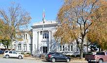 Barry County Courthouse in Cassville | |
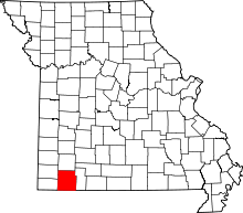 Location in the U.S. state of Missouri | |
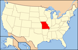 Missouri's location in the U.S. | |
| Founded | January 5, 1835 |
| Named for | William Taylor Barry |
| Seat | Cassville |
| Largest city | Monett |
| Area | |
| • Total | 791 sq mi (2,049 km2) |
| • Land | 778 sq mi (2,015 km2) |
| • Water | 13 sq mi (34 km2), 1.6% |
| Population (est.) | |
| • (2015) | 35,829 |
| • Density | 46/sq mi (18/km²) |
| Congressional district | 7th |
| Time zone | Central: UTC-6/-5 |

Barry County is a county located in the southwest portion of the U.S. state of Missouri. As of the 2010 Census, the population was 35,597.[1] Its county seat is Cassville.[2] The county was organized in 1835 and named after William Taylor Barry, a U.S. Postmaster General from Kentucky.[3]
Geography
According to the U.S. Census Bureau, the county has a total area of 791 square miles (2,050 km2), of which 778 square miles (2,020 km2) is land and 13 square miles (34 km2) (1.6%) is water.[4] Roaring River State Park is located in the southern part of the county, amid the Mark Twain National Forest.
Adjacent counties
- Lawrence County (north)
- Stone County (east)
- Carroll County, Arkansas (southeast)
- Benton County, Arkansas (south)
- McDonald County (southwest)
- Newton County (northwest)
Major highways
National protected area
- Mark Twain National Forest (part)
Demographics
| Historical population | |||
|---|---|---|---|
| Census | Pop. | %± | |
| 1840 | 4,745 | — | |
| 1850 | 3,467 | −26.9% | |
| 1860 | 7,995 | 130.6% | |
| 1870 | 10,373 | 29.7% | |
| 1880 | 14,405 | 38.9% | |
| 1890 | 22,943 | 59.3% | |
| 1900 | 25,532 | 11.3% | |
| 1910 | 23,869 | −6.5% | |
| 1920 | 23,473 | −1.7% | |
| 1930 | 22,803 | −2.9% | |
| 1940 | 23,546 | 3.3% | |
| 1950 | 21,755 | −7.6% | |
| 1960 | 18,921 | −13.0% | |
| 1970 | 19,597 | 3.6% | |
| 1980 | 24,408 | 24.5% | |
| 1990 | 27,547 | 12.9% | |
| 2000 | 34,010 | 23.5% | |
| 2010 | 35,597 | 4.7% | |
| Est. 2015 | 35,829 | [5] | 0.7% |
| U.S. Decennial Census[6] 1790-1960[7] 1900-1990[8] 1990-2000[9] 2010-2015[1] | |||
As of the census[10] of 2000, there were 34,010 people, 13,398 households, and 9,579 families residing in the county. The population density was 44 people per square mile (17/km²). There were 15,964 housing units at an average density of 20 per square mile (8/km²). The racial makeup of the county was 94.09% White, 0.11% Black or African American, 0.86% Native American, 0.27% Asian, 0.03% Pacific Islander, 3.25% from other races, and 1.38% from two or more races. Approximately 5.04% of the population were Hispanic or Latino of any race. 26.5% were of American, 15.5% German, 11.7% English and 10.4% Irish ancestry.
There were 13,398 households out of which 31.20% had children under the age of 18 living with them, 59.30% were married couples living together, 8.40% had a female householder with no husband present, and 28.50% were non-families. 24.70% of all households were made up of individuals and 11.60% had someone living alone who was 65 years of age or older. The average household size was 2.51 and the average family size was 2.98.
In the county the population was spread out with 26.10% under the age of 18, 7.80% from 18 to 24, 26.10% from 25 to 44, 23.90% from 45 to 64, and 16.10% who were 65 years of age or older. The median age was 38 years. For every 100 females there were 98.30 males. For every 100 females age 18 and over, there were 95.60 males.
The median income for a household in the county was $28,906, and the median income for a family was $34,043. Males had a median income of $25,381 versus $18,631 for females. The per capita income for the county was $14,980. About 11.80% of families and 16.60% of the population were below the poverty line, including 23.50% of those under age 18 and 11.90% of those age 65 or over.
Education
Public schools
- Cassville R-IV School District – Cassville
- Eunice Thomas Elementary School (PK-02)
- Cassville Intermediate School (03-05)
- Cassville Middle School (06-08)
- Cassville High School (09-12)
- Exeter R-VI School District – Exeter
- Exeter Elementary School (K-08)
- Exeter High School (09-12)
- Monett R-I School District – Monett
- Monett Elementary School (PK-02)
- Central Park Elementary School (03-04)
- Monett Intermediate School (05-06)
- Monett Middle School (07-08)
- Monett High School (09-12)
- Purdy R-II School District – Purdy
- Purdy Elementary School (K-04)
- Purdy Middle School (05-08)
- Purdy High School (09-12)
- Shell Knob School District No. 78 – Shell Knob
- Shell Knob Elementary School (K-08)
- Southwest R-V School District – Washburn
- Southwest Elementary School (PK-04)
- Southwest Middle School (05-08)
- Southwest High School (09-12)
- Wheaton R-III School District – Wheaton
- Wheaton Elementary School (PK-06)
- Wheaton High School (07-12)
Private schools
- St. Lawrence Catholic School – Monett (K-06) – Roman Catholic
Politics
Local
| Barry County, Missouri | ||||
|---|---|---|---|---|
| Elected countywide officials | ||||
| Assessor | Sherry Sears | Republican | ||
| Circuit Clerk | Craig Williams | Republican | ||
| County Clerk | Gary Youngblood | Republican | ||
| Collector | Janice Varner | Republican | ||
| Commissioner (Presiding) |
Cherry Warren | Republican | ||
| Commissioner (District 1) |
Frank Washburn | Republican | ||
| Commissioner (District 2) |
Wayne Hendrix | Democratic | ||
| Coroner | Jim Fohn | Republican | ||
| Prosecuting Attorney | Johnnie E. Cox | Republican | ||
| Public Administrator | Pam Modlin | Republican | ||
| Recorder | Craig Williams | Republican | ||
| Sheriff | Mick Epperly | Republican | ||
| Surveyor | Sam Goodman | Republican | ||
| Treasurer | Lois Lowe | Republican | ||
State
| Year | Republican | Democratic | Third Parties |
|---|---|---|---|
| 2012 | 56.68% 7,769 | 40.06% 5,491 | 3.25% 446 |
| 2008 | 49.48% 7,156 | 47.90% 6,928 | 2.62% 379 |
| 2004 | 68.97% 9,594 | 29.81% 4,147 | 1.22% 170 |
| 2000 | 59.91% 7,352 | 38.14% 4,681 | 1.95% 239 |
| 1996 | 55.84% 6,574 | 41.28% 4,859 | 2.88% 339 |
| 1992 | 52.56% 6,529 | 47.44% 5,893 | 0.00% 0 |
All of Barry County is a part of Missouri’s 158th Legislative District in the Missouri House of Representatives and is represented by Scott Fitzpatrick (R-Shell Knob).
All of Barry County is a part of Missouri’s 29th District in the Missouri Senate and is currently represented by David Sater (R-Cassville.
Federal
All of Barry County is included in Missouri's 7th Congressional District and is currently represented by Billy Long (R-Springfield) in the U.S. House of Representatives.
| Party | Candidate | Votes | % | ± | |
|---|---|---|---|---|---|
| Republican | Billy H. Long | 4,984 | 69.72 | ||
| Democratic | Jim Evans | 1,677 | 23.46 | ||
| Libertarian | Kevin Craig | 488 | 6.83 | ||
| Year | Republican | Democratic | Third Parties |
|---|---|---|---|
| 2012 | 71.22% 9,832 | 26.56% 3,667 | 2.22% 307 |
| 2008 | 66.63% 9,758 | 31.62% 4,630 | 1.74% 256 |
| 2004 | 68.92% 9,599 | 30.32% 4,223 | 0.75% 105 |
| 2000 | 63.75% 7,855 | 33.43% 4,135 | 2.81% 348 |
| 1996 | 49.62% 5,855 | 36.88% 4,352 | 13.49% 1,592 |
| 1992 | 43.62% 5,565 | 37.56% 4,791 | 18.86% 2,397 |
Missouri Presidential Preference Primary (2008)
Voters in Barry County from both political parties supported candidates who finished in second place in the state at large and nationally.
- Former Governor Mike Huckabee (R-Arkansas) received more votes, a total of 2,396, than any candidate from either party in Barry County during the 2008 presidential primary.
| Barry County, Missouri | ||
|---|---|---|
| 2008 Republican primary in Missouri | ||
| John McCain | 1,365 (28.31%) | |
| Mike Huckabee | 2,396 (49.69%) | |
| Mitt Romney | 739 (15.33%) | |
| Ron Paul | 2.66 (5.52%) | |
| Barry County, Missouri | ||
|---|---|---|
| 2008 Democratic primary in Missouri | ||
| Hillary Clinton | 1,976 (65.52%) | |
| Barack Obama | 919 (30.47%) | |
| John Edwards (withdrawn) | 93 (3.08%) | |
Communities
Cities
Villages
Unincorporated communities
Townships
Barry County is divided into 25 townships:
See also
References
- 1 2 "State & County QuickFacts". United States Census Bureau. Retrieved September 7, 2013.
- ↑ "Find a County". National Association of Counties. Archived from the original on 2012-07-12. Retrieved 2011-06-07.
- ↑ Eaton, David Wolfe (1916). How Missouri Counties, Towns and Streams Were Named. The State Historical Society of Missouri. p. 205.
- ↑ "2010 Census Gazetteer Files". United States Census Bureau. August 22, 2012. Retrieved November 13, 2014.
- ↑ "County Totals Dataset: Population, Population Change and Estimated Components of Population Change: April 1, 2010 to July 1, 2015". Retrieved July 2, 2016.
- ↑ "U.S. Decennial Census". United States Census Bureau. Archived from the original on May 11, 2015. Retrieved November 13, 2014.
- ↑ "Historical Census Browser". University of Virginia Library. Retrieved November 13, 2014.
- ↑ "Population of Counties by Decennial Census: 1900 to 1990". United States Census Bureau. Retrieved November 13, 2014.
- ↑ "Census 2000 PHC-T-4. Ranking Tables for Counties: 1990 and 2000" (PDF). United States Census Bureau. Retrieved November 13, 2014.
- ↑ "American FactFinder". United States Census Bureau. Archived from the original on 2013-09-11. Retrieved 2011-05-14.
External links
- Barry County Genealogy and History
- Digitized 1930 Plat Book of Barry County from University of Missouri Division of Special Collections, Archives, and Rare Books
- Barry County Sheriff's Office
 |
Newton County | Lawrence County | | |
| |
Stone County | |||
| ||||
| | ||||
| McDonald County | Benton County, Arkansas | Carroll County, Arkansas |
Municipalities and communities of Barry County, Missouri, United States | ||
|---|---|---|
| Cities | | |
| Villages | ||
| Townships | ||
| CDPs | ||
| Unincorporated communities | ||
| Ghost towns | ||
| Footnotes | ‡This populated place also has portions in an adjacent county or counties | |
Coordinates: 36°43′N 93°50′W / 36.71°N 93.83°W