Aukena
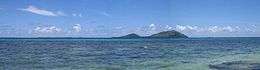 View of Aukena from Mangareva | |
 Aukena | |
| Geography | |
|---|---|
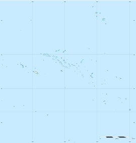
| Location | Pacific Ocean |
| Coordinates | 23°06′42″S 134°54′01″W / 23.11167°S 134.90028°WCoordinates: 23°06′42″S 134°54′01″W / 23.11167°S 134.90028°W |
| Archipelago | Tuamotus |
| Area | 1.35 km2 (0.52 sq mi) |
| Length | 2.5 km (1.55 mi) |
| Width | 0.5 km (0.31 mi) |
| Highest elevation | 198 m (650 ft) |
| Highest point | (unnamed) |
| Administration | |
|
France | |
| Overseas collectivity | French Polynesia |
| Administrative subdivision | Tuamotus |
| Commune | Gambier Islands |
| Demographics | |
| Population | 40[1] (2012) |
| Pop. density | 30 /km2 (80 /sq mi) |
Aukena is the 4th largest of the Gambier Islands in French Polynesia. Aukena is located about halfway between Mangareva and Akamaru, or about 5 km southeast of Mangareva. Aukena is approximately 2.5 km long and about 0.5 km wide, with a total area of 1.35 km².
Gallery
-
Watchtower. Background: Mangareva Island
-

Watchtower. Background: Mt. Duff
-

Ruins of Re'e Seminary College, the first college of French Polynesia
-
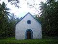
Church of St.Raphael
-
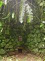
Oven for coral lime. Missionaries used it to build various churches in the Gambier Islands.
-
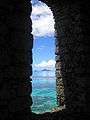
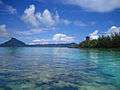
View from the watchtower. View is of Manui and Kamaka
References
- ↑ "Population". Institut de la statistique de la Polynésie française. Retrieved 25 September 2014.
| Wikimedia Commons has media related to Aukena. |
Tuamotus Gambiers | Islands/Atolls: | ||
|---|---|---|---|
| Island groups: | |||
This article is issued from Wikipedia - version of the 11/11/2016. The text is available under the Creative Commons Attribution/Share Alike but additional terms may apply for the media files.