Takapoto
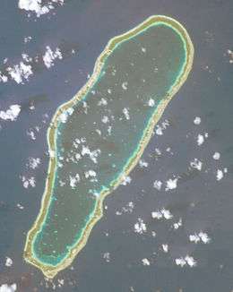 NASA picture of Takapoto Atoll | |
 Takapoto | |
| Geography | |
|---|---|
| Location | Pacific Ocean |
| Coordinates | 14°37′39″S 145°12′18″W / 14.62750°S 145.20500°WCoordinates: 14°37′39″S 145°12′18″W / 14.62750°S 145.20500°W |
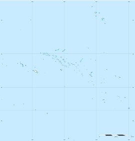
| Archipelago | Tuamotus |
| Area |
85 km2 (33 sq mi) (lagoon) 15 km2 (6 sq mi) (above water) |
| Length | 20 km (12 mi) |
| Width | 6.7 km (4.16 mi) |
| Administration | |
|
France | |
| Overseas collectivity | French Polynesia |
| Administrative subdivision | Tuamotus |
| Commune | Takaroa |
| Largest settlement | Fakatopatere |
| Demographics | |
| Population | 380[1] (2012) |
Takapoto, Tua-poto or Oura, is an atoll in the Tuamotu group in French Polynesia. It has a length of 10 square kilometres (4 square miles) and a width of 6.7 kilometres (4.2 miles).
The nearest land is Takaroa Atoll, located 10 kilometres (6 miles) to the northeast.
Takapoto's lagoon has a high salinity and a strong phytoplankton biomass.
Geographically Takapoto is part of the King George Islands (Iles du Roi Georges) subgroup, which includes: Ahe, Manihi, Takapoto, Takaroa and Tikei.
Takapoto Atoll has 380 inhabitants. Fakatopatere, the main village on Takapoto, is located at the southern end of the atoll.
History
The first recorded European to sight Takapoto Atoll was Jacob Le Maire in 1616.[2]
Takapoto Atoll was visited by the Charles Wilkes expedition in September 1839.
Takapoto Airport was inaugurated in 1973.
Administration
The commune of Takaroa-Takapoto consists of the atolls of Takaroa and Takapoto, and Tikei Island.
See also
References
- ↑ "Population". Institut de la statistique de la Polynésie française. Retrieved 20 October 2014.
- ↑ Sample Chapter(s) for Historical%2
External links
Tuamotus Gambiers | Islands/Atolls: | ||
|---|---|---|---|
| Island groups: | |||