Nihiru
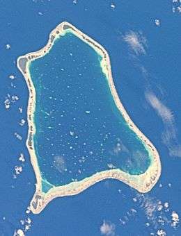 NASA picture of Nihiru Atoll | |
 Nihiru | |
| Geography | |
|---|---|
| Location | Pacific Ocean |
| Coordinates | 16°44′S 142°50′W / 16.733°S 142.833°WCoordinates: 16°44′S 142°50′W / 16.733°S 142.833°W |
| Archipelago | Tuamotus |
| Area |
79 km2 (31 sq mi) (lagoon) 20 km2 (8 sq mi) (above water) |
| Length | 14 km (8.7 mi) |
| Width | 10.5 km (6.52 mi) |
| Administration | |
|
France | |
| Overseas collectivity | French Polynesia |
| Administrative subdivision | Tuamotus |
| Commune | Makemo |
| Demographics | |
| Population | 11[1] (2012) |
NASA picture of Nihiru Atoll.
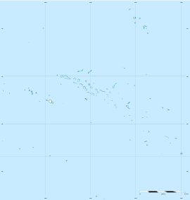
Nihiru, or Nikia, is one of the Tuamotu atolls in French Polynesia. It is a relatively small atoll located 49 km to the east of Makemo Atoll and 30 km northeast of Marutea Atoll.
Nihiru Atoll is roughly triangular in shape. It measures 14 km in length with a maximum width of 10.5 km. Its lagoon has an area of 79 km².
Nihiru had 11 inhabitants in 2012, most of whom originated from Taenga.
History
The first recorded European to arrive to Nihiru was Russian oceanic explorer Fabian Gottlieb von Bellingshausen in 1820 on ships Vostok and Mirni. He named this atoll "Nigeri".
Administration
Nihiru Atoll belongs to the commune of Makemo, which consists of the atolls of Makemo, Haraiki, Marutea Nord, Katiu, Tuanake, Hiti, Tepoto Sud, Raroia, Takume, Taenga and Nihiru.
References
- ↑ "Population". Institut de la statistique de la Polynésie française. Retrieved 9 October 2014.
External links
Tuamotus Gambiers | Islands/Atolls: | ||
|---|---|---|---|
| Island groups: | |||
This article is issued from Wikipedia - version of the 11/17/2016. The text is available under the Creative Commons Attribution/Share Alike but additional terms may apply for the media files.