Brainerd, Minnesota micropolitan area
The Brainerd Micropolitan Statistical Area, as defined by the United States Census Bureau, is an area consisting of two counties in central Minnesota, anchored by the city of Brainerd. As of February 4, 2011 estimate placed the population at 91,067.[1]
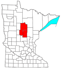
Counties
Communities
- Places with more than 10,000 inhabitants
- Brainerd (Principal city)
- Places with 1,000 to 10,000 inhabitants
- Places with 500 to 1,000 inhabitants
- Cass Lake
- Deerwood
- East Gull Lake
- Emily
- Lake Shore
- Motley (partial)
- Places with less than 500 inhabitants
- Unorganized territories
- Unincorporated places
Townships
Cass County
Crow Wing County
Demographics
As of the census[2] of 2000, there were 82,249 people, 33,143 households, and 22,908 families residing within the μSA. The racial makeup of the μSA was 93.97% White, 0.24% African American, 4.30% Native American, 0.28% Asian, 0.02% Pacific Islander, 0.18% from other races, and 1.01% from two or more races. Hispanic or Latino of any race were 0.73% of the population.
The median income for a household in the μSA was $35,961, and the median income for a family was $42,502. Males had a median income of $31,968 versus $22,064 for females. The per capita income for the μSA was $18,182.
See also
References
- ↑ "Table 1. Annual Estimates of the Population of Metropolitan and Micropolitan Statistical Areas: April 1, 2000 to July 1, 2009 (CBSA-EST2009-01)". 2009 Population Estimates. United States Census Bureau, Population Division. 2010-03-23. Archived from the original (CSV) on 2010-06-15. Retrieved 2010-03-24.
- ↑ "American FactFinder". United States Census Bureau. Archived from the original on 2013-09-11. Retrieved 2008-01-31.
Cities in the Brainerd Lakes area, Minnesota | |||||||
|---|---|---|---|---|---|---|---|
| Core City | | ||||||
| Surrounding communities |
| ||||||
| Counties | |||||||
† indicates a county seat. ‡ indicates that it is partially in the micropolitan area. § indicates a CDP. | |||||||