Humansville, Missouri
| Humansville, Missouri | |
|---|---|
| City | |
 Location of Humansville, Missouri | |
| Coordinates: 37°47′44″N 93°34′42″W / 37.79556°N 93.57833°WCoordinates: 37°47′44″N 93°34′42″W / 37.79556°N 93.57833°W | |
| Country | United States |
| State | Missouri |
| County | Polk |
| Area[1] | |
| • Total | 1.19 sq mi (3.08 km2) |
| • Land | 1.18 sq mi (3.06 km2) |
| • Water | 0.01 sq mi (0.03 km2) |
| Elevation | 965 ft (294 m) |
| Population (2010)[2] | |
| • Total | 1,048 |
| • Estimate (2012[3]) | 1,041 |
| • Density | 888.1/sq mi (342.9/km2) |
| Time zone | Central (CST) (UTC-6) |
| • Summer (DST) | CDT (UTC-5) |
| ZIP code | 65674 |
| Area code(s) | 417 |
| FIPS code | 29-33706 [4] |
| GNIS feature ID | 719986[5] |
Humansville is a city in Polk County, Missouri.[5] As of the 2010 census, the city population was 1,048.[6] It is part of the Springfield, Missouri Metropolitan Statistical Area. Evan Debarbeque is the current mayor.
History
.jpg)
Humansville was named for James Human, who settled in the area in 1834.[7] During the U.S. Civil War, a skirmish was fought on the town's outskirts on March 26, 1862, in which about 300 to 400 Missouri Confederates under Col. James M. Frazier of Cedar County clashed with two companies of the pro-Union Missouri State Militia. Casualties were few, but Col. Frazier was himself mortally wounded, which caused the Confederates to retreat.[8] Humansville later was occupied by a garrison of about 150 Union troops. During Shelby's Raid of 1863, the Confederate horse soldiers overwhelmed the garrison, with about 17 men killed and wounded in the fight.
The town was incorporated in 1873, but it did not elect its first mayor until 1886.
Geography
Humansville sits on Brush Creek and the line of the old Kansas City, Clinton and Springfield Railway. It is 18 mi (29 km) northwest of Bolivar, the seat of Polk County.
According to the United States Census Bureau, the city has a total area of 1.19 square miles (3.08 km2), of which, 1.18 square miles (3.06 km2) is land and 0.01 square miles (0.03 km2) is water.[1]
Demographics
| Historical population | |||
|---|---|---|---|
| Census | Pop. | %± | |
| 1880 | 328 | — | |
| 1890 | 791 | 141.2% | |
| 1900 | 1,055 | 33.4% | |
| 1910 | 913 | −13.5% | |
| 1920 | 947 | 3.7% | |
| 1930 | 1,022 | 7.9% | |
| 1940 | 786 | −23.1% | |
| 1950 | 803 | 2.2% | |
| 1960 | 745 | −7.2% | |
| 1970 | 825 | 10.7% | |
| 1980 | 907 | 9.9% | |
| 1990 | 1,084 | 19.5% | |
| 2000 | 946 | −12.7% | |
| 2010 | 1,048 | 10.8% | |
| Est. 2015 | 1,038 | [9] | −1.0% |
| U.S. Decennial Census | |||
2010 census
As of the census[2] of 2010, there were 1,048 people, 366 households, and 227 families residing in the city. The population density was 888.1 inhabitants per square mile (342.9/km2). There were 461 housing units at an average density of 390.7 per square mile (150.9/km2). The racial makeup of the city was 96.6% White, 0.1% African American, 0.6% Native American, 0.1% Asian, 0.2% from other races, and 2.5% from two or more races. Hispanic or Latino of any race were 3.8% of the population.
There were 366 households of which 31.7% had children under the age of 18 living with them, 42.3% were married couples living together, 13.9% had a female householder with no husband present, 5.7% had a male householder with no wife present, and 38.0% were non-families. 34.2% of all households were made up of individuals and 20.2% had someone living alone who was 65 years of age or older. The average household size was 2.42 and the average family size was 3.04.
The median age in the city was 45.9 years. 21.4% of residents were under the age of 18; 7.7% were between the ages of 18 and 24; 20% were from 25 to 44; 25.5% were from 45 to 64; and 25.7% were 65 years of age or older. The gender makeup of the city was 46.9% male and 53.1% female.
2000 census
As of the census[4] of 2000, there were 946 people, 389 households, and 219 families residing in the city. The population density was 794.0 people per square mile (306.9/km²). There were 465 housing units at an average density of 390.3 per square mile (150.9/km²). The racial makeup of the city was 98.20% White, 0.42% African American, 0.32% Native American, 0.21% Asian, and 0.85% from two or more races. Hispanic or Latino of any race were 0.63% of the population.
There were 389 households out of which 24.7% had children under the age of 18 living with them, 42.4% were married couples living together, 11.6% had a female householder with no husband present, and 43.7% were non-families. 39.3% of all households were made up of individuals and 22.4% had someone living alone who was 65 years of age or older. The average household size was 2.15 and the average family size was 2.89.
In the city the population was spread out with 21.2% under the age of 18, 5.5% from 18 to 24, 24.6% from 25 to 44, 20.6% from 45 to 64, and 28.0% who were 65 years of age or older. The median age was 44 years. For every 100 females there were 86.2 males. For every 100 females age 18 and over, there were 78.7 males.
The median income for a household in the city was $19,821, and the median income for a family was $29,018. Males had a median income of $21,181 versus $14,423 for females. The per capita income for the city was $11,051. About 11.9% of families and 18.7% of the population were below the poverty line, including 16.0% of those under age 18 and 22.0% of those age 65 or over.
Notable people
- Zoë Akins, (1886–1958), became a successful poet, playwright, and screenwriter.
- Edgar Buchanan (1903–1979), who had a long career in movies and television.[10] He portrayed Uncle Joe on Petticoat Junction in the 1960s.
- James B. Potter, Jr. (born 1931), Los Angeles City Council member, 1963–1971
References
- 1 2 "US Gazetteer files 2010". United States Census Bureau. Archived from the original on January 24, 2012. Retrieved 2012-07-08.
- 1 2 "American FactFinder". United States Census Bureau. Retrieved 2012-07-08.
- ↑ "Population Estimates". United States Census Bureau. Archived from the original on June 17, 2013. Retrieved 2013-05-30.
- 1 2 "American FactFinder". United States Census Bureau. Archived from the original on September 11, 2013. Retrieved 2008-01-31.
- 1 2 U.S. Geological Survey Geographic Names Information System: Humansville
- ↑ "2010 City Population and Housing Occupancy Status". U.S. Census Bureau. Archived from the original on July 21, 2011. Retrieved February 8, 2012.
- ↑ Eaton, David Wolfe (1917). How Missouri Counties, Towns and Streams Were Named. The State Historical Society of Missouri. p. 343.
- ↑ http://ozarks-history.blogspot.com/2013/03/skirmish-at-humansville.html
- ↑ "Annual Estimates of the Resident Population for Incorporated Places: April 1, 2010 to July 1, 2015". Retrieved July 2, 2016.
- ↑ Wilson, Earl (Nov 27, 1969). "Small Towns Have Produced Many Big Stars". The Milwaukee Sentinel. pp. A33. Retrieved 22 May 2015.
Further reading
- Encyclopedia of the History of Missouri, by Howard Louis Conrad, 1901. Page 324.
- Woman's Who's Who of America, by John William Leonard, 1914. Page 40.
External links
- Historic maps of Humansville in the Sanborn Maps of Missouri Collection at the University of Missouri
Municipalities and communities of Polk County, Missouri, United States | ||
|---|---|---|
| Cities | 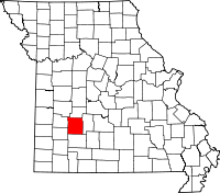 | |
| Villages | ||
| Townships |
| |
| Unincorporated communities | ||
| Ghost towns |
| |