Lahourcade
| Lahourcade | |
|---|---|
|
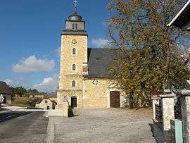
Lahourcade church | |
 Lahourcade | |
|
Location within Nouvelle-Aquitaine region  Lahourcade | |
| Coordinates: 43°21′19″N 0°36′58″W / 43.3553°N 0.6161°WCoordinates: 43°21′19″N 0°36′58″W / 43.3553°N 0.6161°W | |
| Country | France |
| Region | Nouvelle-Aquitaine |
| Department | Pyrénées-Atlantiques |
| Arrondissement | Oloron-Sainte-Marie |
| Canton | Monein |
| Intercommunality | Monein |
| Government | |
| • Mayor (2008–2014) | Gérard Paloumet |
| Area1 | 10.94 km2 (4.22 sq mi) |
| Population (2006)2 | 681 |
| • Density | 62/km2 (160/sq mi) |
| Time zone | CET (UTC+1) |
| • Summer (DST) | CEST (UTC+2) |
| INSEE/Postal code | 64306 / 64150 |
| Elevation |
110–267 m (361–876 ft) (avg. 155 m or 509 ft) |
|
1 French Land Register data, which excludes lakes, ponds, glaciers > 1 km² (0.386 sq mi or 247 acres) and river estuaries. 2 Population without double counting: residents of multiple communes (e.g., students and military personnel) only counted once. | |
Lahourcade is a commune in the Pyrénées-Atlantiques department in south-western France.
Geography
Neighbouring Communes
History
Administration
List of successive mayors of Lahourcade
| Name | Political Party | In office |
|---|---|---|
| Michel Ardohain | 1989 - 1995 | |
| Jean-Pierre Ladaurade | 1995 - 2008 | |
| Gérard Paloumet | 2008 - 2014 |
See also
References
| Wikimedia Commons has media related to Lahourcade. |
This article is issued from Wikipedia - version of the 11/17/2014. The text is available under the Creative Commons Attribution/Share Alike but additional terms may apply for the media files.