Sus, Pyrénées-Atlantiques
| Sus | |
|---|---|
|
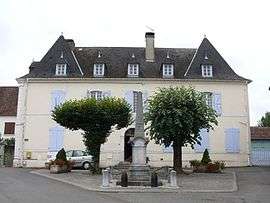
The mairie and school | |
 Sus | |
|
Location within Nouvelle-Aquitaine region  Sus | |
| Coordinates: 43°18′26″N 0°45′55″W / 43.3072°N 0.7653°WCoordinates: 43°18′26″N 0°45′55″W / 43.3072°N 0.7653°W | |
| Country | France |
| Region | Nouvelle-Aquitaine |
| Department | Pyrénées-Atlantiques |
| Arrondissement | Oloron-Sainte-Marie |
| Canton | Navarrenx |
| Intercommunality | Communauté de communes du canton de Navarrenx |
| Government | |
| • Mayor (2014–2020) | Marie-France Lassalle |
| Area1 | 11.50 km2 (4.44 sq mi) |
| Population (2013)2 | 386 |
| • Density | 34/km2 (87/sq mi) |
| Time zone | CET (UTC+1) |
| • Summer (DST) | CEST (UTC+2) |
| INSEE/Postal code | 64529 / 64190 |
| Elevation |
118–263 m (387–863 ft) (avg. 164 m or 538 ft) |
|
1 French Land Register data, which excludes lakes, ponds, glaciers > 1 km² (0.386 sq mi or 247 acres) and river estuaries. 2 Population without double counting: residents of multiple communes (e.g., students and military personnel) only counted once. | |
Sus is a commune in the Pyrénées-Atlantiques department and Nouvelle-Aquitaine region of south-western France.
See also
References
| Wikimedia Commons has media related to Sus (Pyrénées-Atlantiques). |
This article is issued from Wikipedia - version of the 11/3/2016. The text is available under the Creative Commons Attribution/Share Alike but additional terms may apply for the media files.