Auradou
| Auradou | ||
|---|---|---|
|
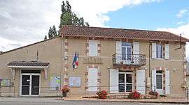
The town hall in Auradou | ||
| ||
 Auradou | ||
|
Location within Nouvelle-Aquitaine region  Auradou | ||
| Coordinates: 44°20′06″N 0°48′40″E / 44.335°N 0.811°ECoordinates: 44°20′06″N 0°48′40″E / 44.335°N 0.811°E | ||
| Country | France | |
| Region | Nouvelle-Aquitaine | |
| Department | Lot-et-Garonne | |
| Arrondissement | Villeneuve-sur-Lot | |
| Canton | Penne-d'Agenais | |
| Intercommunality | Penne-d'Agenais | |
| Government | ||
| • Mayor (2008–2014) | Josette Durfort-Viel | |
| Area1 | 11.17 km2 (4.31 sq mi) | |
| Population (2009)2 | 379 | |
| • Density | 34/km2 (88/sq mi) | |
| Time zone | CET (UTC+1) | |
| • Summer (DST) | CEST (UTC+2) | |
| INSEE/Postal code | 47017 / 47140 | |
| Elevation |
69–222 m (226–728 ft) (avg. 50 m or 160 ft) | |
|
1 French Land Register data, which excludes lakes, ponds, glaciers > 1 km² (0.386 sq mi or 247 acres) and river estuaries. 2 Population without double counting: residents of multiple communes (e.g., students and military personnel) only counted once. | ||
.svg.png)
Auradou is a commune in the Lot-et-Garonne department in southwestern France.
Population
| Historical population | ||
|---|---|---|
| Year | Pop. | ±% |
| 1800 | 614 | — |
| 1806 | 657 | +7.0% |
| 1821 | 602 | −8.4% |
| 1831 | 598 | −0.7% |
| 1836 | 610 | +2.0% |
| 1841 | 641 | +5.1% |
| 1846 | 602 | −6.1% |
| 1851 | 502 | −16.6% |
| 1856 | 480 | −4.4% |
| 1861 | 480 | +0.0% |
| 1866 | 481 | +0.2% |
| 1872 | 421 | −12.5% |
| 1876 | 410 | −2.6% |
| 1881 | 358 | −12.7% |
| 1886 | 387 | +8.1% |
| 1891 | 375 | −3.1% |
| 1896 | 352 | −6.1% |
| 1901 | 363 | +3.1% |
| 1906 | 349 | −3.9% |
| 1911 | 332 | −4.9% |
| 1921 | 287 | −13.6% |
| 1926 | 293 | +2.1% |
| 1931 | 321 | +9.6% |
| 1936 | 321 | +0.0% |
| 1946 | 304 | −5.3% |
| 1954 | 287 | −5.6% |
| 1962 | 238 | −17.1% |
| 1968 | 227 | −4.6% |
| 1975 | 220 | −3.1% |
| 1982 | 256 | +16.4% |
| 1990 | 311 | +21.5% |
| 1999 | 258 | −17.0% |
| 2006 | 342 | +32.6% |
| 2009 | 379 | +10.8% |
See also
References
| Wikimedia Commons has media related to Auradou. |
This article is issued from Wikipedia - version of the 9/16/2015. The text is available under the Creative Commons Attribution/Share Alike but additional terms may apply for the media files.