Salles, Lot-et-Garonne
| Salles | |
|---|---|
|
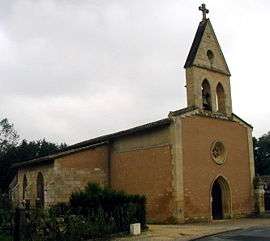
The church in Salles | |
 Salles | |
|
Location within Nouvelle-Aquitaine region  Salles | |
| Coordinates: 44°33′00″N 0°52′19″E / 44.55°N 0.8719°ECoordinates: 44°33′00″N 0°52′19″E / 44.55°N 0.8719°E | |
| Country | France |
| Region | Nouvelle-Aquitaine |
| Department | Lot-et-Garonne |
| Arrondissement | Arrondissement of Villeneuve-sur-Lot |
| Canton | Canton of Monflanquin |
| Intercommunality | Communauté de communes Bastide et Châteaux en Guyenne |
| Government | |
| • Mayor (2008–2014) | Jean-Claude Boucq |
| Area1 | 21.58 km2 (8.33 sq mi) |
| Population (1999)2 | 257 |
| • Density | 12/km2 (31/sq mi) |
| Time zone | CET (UTC+1) |
| • Summer (DST) | CEST (UTC+2) |
| INSEE/Postal code | 47284 / 47150 |
| Elevation |
84–196 m (276–643 ft) (avg. 101 m or 331 ft) |
|
1 French Land Register data, which excludes lakes, ponds, glaciers > 1 km² (0.386 sq mi or 247 acres) and river estuaries. 2 Population without double counting: residents of multiple communes (e.g., students and military personnel) only counted once. | |
Salles is a commune in the Lot-et-Garonne department in south-western France.[1]
Demography
| Year | 1962 | 1968 | 1975 | 1982 | 1990 | 1999 | 2006 |
|---|---|---|---|---|---|---|---|
| Population | 321 | 353 | 330 | 313 | 289 | 257 | 300 |
| From the year 1962 on: No double counting—residents of multiple communes (e.g. students and military personnel) are counted only once. | |||||||
See also
References
| Wikimedia Commons has media related to Salles (Lot-et-Garonne). |
This article is issued from Wikipedia - version of the 3/16/2015. The text is available under the Creative Commons Attribution/Share Alike but additional terms may apply for the media files.