Barbaste
| Barbaste | ||
|---|---|---|
|
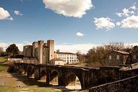
The bridge and the fortified mill in Barbaste | ||
| ||
 Barbaste | ||
|
Location within Nouvelle-Aquitaine region  Barbaste | ||
| Coordinates: 44°10′12″N 0°17′14″E / 44.17°N 0.2872°ECoordinates: 44°10′12″N 0°17′14″E / 44.17°N 0.2872°E | ||
| Country | France | |
| Region | Nouvelle-Aquitaine | |
| Department | Lot-et-Garonne | |
| Arrondissement | Nérac | |
| Canton | Lavardac | |
| Intercommunality | Val d'Albret | |
| Government | ||
| • Mayor (2008–2014) | Bernadette Jayles | |
| Area1 | 38.7 km2 (14.9 sq mi) | |
| Population (2009)2 | 1,494 | |
| • Density | 39/km2 (100/sq mi) | |
| Time zone | CET (UTC+1) | |
| • Summer (DST) | CEST (UTC+2) | |
| INSEE/Postal code | 47021 / 47230 | |
| Elevation |
38–146 m (125–479 ft) (avg. 126 m or 413 ft) | |
|
1 French Land Register data, which excludes lakes, ponds, glaciers > 1 km² (0.386 sq mi or 247 acres) and river estuaries. 2 Population without double counting: residents of multiple communes (e.g., students and military personnel) only counted once. | ||
.svg.png)
Barbaste is a commune in the Lot-et-Garonne department in southwestern France.
Population
| Historical population | ||
|---|---|---|
| Year | Pop. | ±% |
| 1962 | 1,340 | — |
| 1968 | 1,354 | +1.0% |
| 1975 | 1,373 | +1.4% |
| 1982 | 1,316 | −4.2% |
| 1990 | 1,354 | +2.9% |
| 1999 | 1,416 | +4.6% |
| 2006 | 1,472 | +4.0% |
| 2009 | 1,494 | +1.5% |
See also
References
| Wikimedia Commons has media related to Barbaste. |
This article is issued from Wikipedia - version of the 9/16/2015. The text is available under the Creative Commons Attribution/Share Alike but additional terms may apply for the media files.