Bourlens
| Bourlens | |
|---|---|
|
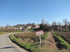
The road into Bourlens | |
 Bourlens | |
|
Location within Nouvelle-Aquitaine region  Bourlens | |
| Coordinates: 44°25′09″N 0°58′19″E / 44.4192°N 0.9719°ECoordinates: 44°25′09″N 0°58′19″E / 44.4192°N 0.9719°E | |
| Country | France |
| Region | Nouvelle-Aquitaine |
| Department | Lot-et-Garonne |
| Arrondissement | Villeneuve-sur-Lot |
| Canton | Tournon-d'Agenais |
| Intercommunality | Tournonnais |
| Government | |
| • Mayor (2008–2014) | Jean-Maire Queyrel |
| Area1 | 15.44 km2 (5.96 sq mi) |
| Population (2009)2 | 360 |
| • Density | 23/km2 (60/sq mi) |
| Time zone | CET (UTC+1) |
| • Summer (DST) | CEST (UTC+2) |
| INSEE/Postal code | 47036 / 47370 |
| Elevation |
96–235 m (315–771 ft) (avg. 180 m or 590 ft) |
|
1 French Land Register data, which excludes lakes, ponds, glaciers > 1 km² (0.386 sq mi or 247 acres) and river estuaries. 2 Population without double counting: residents of multiple communes (e.g., students and military personnel) only counted once. | |
Bourlens is a commune in the Lot-et-Garonne department in southwestern France.
Population
| Historical population | ||
|---|---|---|
| Year | Pop. | ±% |
| 1876 | 535 | — |
| 1881 | 526 | −1.7% |
| 1886 | 519 | −1.3% |
| 1891 | 453 | −12.7% |
| 1896 | 447 | −1.3% |
| 1901 | 413 | −7.6% |
| 1906 | 412 | −0.2% |
| 1911 | 371 | −10.0% |
| 1921 | 335 | −9.7% |
| 1926 | 345 | +3.0% |
| 1931 | 359 | +4.1% |
| 1936 | 369 | +2.8% |
| 1946 | 317 | −14.1% |
| 1954 | 334 | +5.4% |
| 1962 | 338 | +1.2% |
| 1968 | 308 | −8.9% |
| 1975 | 342 | +11.0% |
| 1982 | 368 | +7.6% |
| 1990 | 376 | +2.2% |
| 1999 | 354 | −5.9% |
| 2006 | 372 | +5.1% |
| 2009 | 360 | −3.2% |
See also
References
| Wikimedia Commons has media related to Bourlens. |
This article is issued from Wikipedia - version of the 9/17/2015. The text is available under the Creative Commons Attribution/Share Alike but additional terms may apply for the media files.