Monsempron-Libos
| Monsempron-Libos | ||
|---|---|---|
|
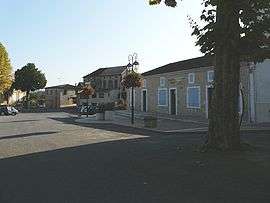
The town hall in Monsempron-Libos | ||
| ||
 Monsempron-Libos | ||
|
Location within Nouvelle-Aquitaine region  Monsempron-Libos | ||
| Coordinates: 44°28′58″N 0°56′39″E / 44.4828°N 0.9442°ECoordinates: 44°28′58″N 0°56′39″E / 44.4828°N 0.9442°E | ||
| Country | France | |
| Region | Nouvelle-Aquitaine | |
| Department | Lot-et-Garonne | |
| Arrondissement | Villeneuve-sur-Lot | |
| Canton | Fumel | |
| Intercommunality | Fumelois-Lémance | |
| Government | ||
| • Mayor (2008–2014) | Jean-Jacques Brouillet | |
| Area1 | 9.05 km2 (3.49 sq mi) | |
| Population (1999)2 | 2,135 | |
| • Density | 240/km2 (610/sq mi) | |
| Time zone | CET (UTC+1) | |
| • Summer (DST) | CEST (UTC+2) | |
| INSEE/Postal code | 47179 / 47500 | |
| Elevation |
59–155 m (194–509 ft) (avg. 116 m or 381 ft) | |
|
1 French Land Register data, which excludes lakes, ponds, glaciers > 1 km² (0.386 sq mi or 247 acres) and river estuaries. 2 Population without double counting: residents of multiple communes (e.g., students and military personnel) only counted once. | ||
.svg.png)
Monsempron-Libos is a commune in the Lot-et-Garonne department in south-western France.
See also
| Wikimedia Commons has media related to Monsempron-Libos. |
This article is issued from Wikipedia - version of the 3/15/2015. The text is available under the Creative Commons Attribution/Share Alike but additional terms may apply for the media files.