Esclottes
| Esclottes | |
|---|---|
|
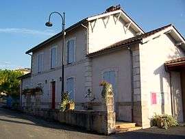
The town hall in Esclottes | |
 Esclottes | |
|
Location within Nouvelle-Aquitaine region  Esclottes | |
| Coordinates: 44°42′33″N 0°08′47″E / 44.7092°N 0.1464°ECoordinates: 44°42′33″N 0°08′47″E / 44.7092°N 0.1464°E | |
| Country | France |
| Region | Nouvelle-Aquitaine |
| Department | Lot-et-Garonne |
| Arrondissement | Arrondissement of Marmande |
| Canton | Canton of Duras |
| Intercommunality | Communauté de communes du Pays de Duras |
| Government | |
| • Mayor (2001–2008) | Erik Seillier |
| Area1 | 9.24 km2 (3.57 sq mi) |
| Population (1999)2 | 172 |
| • Density | 19/km2 (48/sq mi) |
| Time zone | CET (UTC+1) |
| • Summer (DST) | CEST (UTC+2) |
| INSEE/Postal code | 47089 / 47120 |
| Elevation |
38–117 m (125–384 ft) (avg. 110 m or 360 ft) |
|
1 French Land Register data, which excludes lakes, ponds, glaciers > 1 km² (0.386 sq mi or 247 acres) and river estuaries. 2 Population without double counting: residents of multiple communes (e.g., students and military personnel) only counted once. | |
Esclottes is a commune in the Lot-et-Garonne department in south-western France.
See also
| Wikimedia Commons has media related to Esclottes. |
This article is issued from Wikipedia - version of the 3/14/2015. The text is available under the Creative Commons Attribution/Share Alike but additional terms may apply for the media files.