Pont-du-Casse
| Pont-du-Casse | ||
|---|---|---|
|
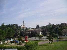
A general view of Pont-du-Casse | ||
| ||
 Pont-du-Casse | ||
|
Location within Nouvelle-Aquitaine region  Pont-du-Casse | ||
| Coordinates: 44°13′57″N 0°40′55″E / 44.2325°N 0.6819°ECoordinates: 44°13′57″N 0°40′55″E / 44.2325°N 0.6819°E | ||
| Country | France | |
| Region | Nouvelle-Aquitaine | |
| Department | Lot-et-Garonne | |
| Arrondissement | Arrondissement of Agen | |
| Canton | Canton of Agen-Nord-Est | |
| Intercommunality | - | |
| Government | ||
| • Mayor (2008–2014) | Gilbert Fongaro (PR) | |
| Area1 | 19.1 km2 (7.4 sq mi) | |
| Population (2006)2 | 4,306 | |
| • Density | 230/km2 (580/sq mi) | |
| Time zone | CET (UTC+1) | |
| • Summer (DST) | CEST (UTC+2) | |
| INSEE/Postal code | 47209 / 47480 | |
| Elevation |
53–204 m (174–669 ft) (avg. 63 m or 207 ft) | |
|
1 French Land Register data, which excludes lakes, ponds, glaciers > 1 km² (0.386 sq mi or 247 acres) and river estuaries. 2 Population without double counting: residents of multiple communes (e.g., students and military personnel) only counted once. | ||

Pont-du-Casse is a commune in the Lot-et-Garonne department in south-western France.
See also
| Wikimedia Commons has media related to Pont-du-Casse. |
This article is issued from Wikipedia - version of the 3/15/2015. The text is available under the Creative Commons Attribution/Share Alike but additional terms may apply for the media files.