Saint-Jean-de-Thurac
| Saint-Jean-de-Thurac | |
|---|---|
|
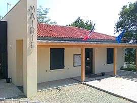
The town hall in Saint-Jean-de-Thurac | |
 Saint-Jean-de-Thurac | |
|
Location within Nouvelle-Aquitaine region  Saint-Jean-de-Thurac | |
| Coordinates: 44°09′18″N 0°44′38″E / 44.155°N 0.7439°ECoordinates: 44°09′18″N 0°44′38″E / 44.155°N 0.7439°E | |
| Country | France |
| Region | Nouvelle-Aquitaine |
| Department | Lot-et-Garonne |
| Arrondissement | Agen |
| Canton | Puymirol |
| Intercommunality | Deux Séounes |
| Government | |
| • Mayor (2001–2008) | Jean Prouzet |
| Area1 | 5.12 km2 (1.98 sq mi) |
| Population (1999)2 | 408 |
| • Density | 80/km2 (210/sq mi) |
| Time zone | CET (UTC+1) |
| • Summer (DST) | CEST (UTC+2) |
| INSEE/Postal code | 47248 / 47270 |
| Elevation |
45–186 m (148–610 ft) (avg. 91 m or 299 ft) |
|
1 French Land Register data, which excludes lakes, ponds, glaciers > 1 km² (0.386 sq mi or 247 acres) and river estuaries. 2 Population without double counting: residents of multiple communes (e.g., students and military personnel) only counted once. | |
Saint-Jean-de-Thurac is a commune in the Lot-et-Garonne department in south-western France. It lies to the west of the town of Agen. The departmental road D813 which routes westward from Agen to Toulouse passes through the commune. There are no commercial premises in this commune and the district derives its name from a thirteenth-century Catholic church which lies just off the D813. Beside the church is an elementary school and the Mairie, or town hall, building.
Demography
| Year | 1962 | 1968 | 1975 | 1982 | 1990 | 1999 | 2006 |
|---|---|---|---|---|---|---|---|
| Population | 269 | 281 | 325 | 344 | 381 | 408 | 483 |
| From the year 1962 on: No double counting—residents of multiple communes (e.g. students and military personnel) are counted only once. | |||||||
See also
References
| Wikimedia Commons has media related to Saint-Jean-de-Thurac. |
This article is issued from Wikipedia - version of the 3/16/2015. The text is available under the Creative Commons Attribution/Share Alike but additional terms may apply for the media files.