La Celle-sur-Loire
| La Celle-sur-Loire | |
|---|---|
 | |
 La Celle-sur-Loire | |
|
Location within Bourgogne-Franche-Comté region  La Celle-sur-Loire | |
| Coordinates: 47°28′23″N 2°55′50″E / 47.4731°N 2.9306°ECoordinates: 47°28′23″N 2°55′50″E / 47.4731°N 2.9306°E | |
| Country | France |
| Region | Bourgogne-Franche-Comté |
| Department | Nièvre |
| Arrondissement | Cosne-Cours-sur-Loire |
| Canton | Cosne-Cours-sur-Loire-Nord |
| Intercommunality | Loire et Nohain |
| Government | |
| • Mayor (2014–2020) | Danielle Roy |
| Area1 | 21.17 km2 (8.17 sq mi) |
| Population (1999)2 | 798 |
| • Density | 38/km2 (98/sq mi) |
| Time zone | CET (UTC+1) |
| • Summer (DST) | CEST (UTC+2) |
| INSEE/Postal code | 58044 / 58440 |
| Elevation | 132–233 m (433–764 ft) |
|
1 French Land Register data, which excludes lakes, ponds, glaciers > 1 km² (0.386 sq mi or 247 acres) and river estuaries. 2 Population without double counting: residents of multiple communes (e.g., students and military personnel) only counted once. | |
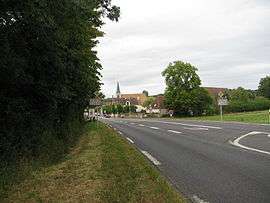
La Celle-sur-Loire is a commune in the Nièvre department in central France.
Population
| Historical population | ||
|---|---|---|
| Year | Pop. | ±% |
| 1793 | 724 | — |
| 1806 | 575 | −20.6% |
| 1821 | 656 | +14.1% |
| 1831 | 705 | +7.5% |
| 1841 | 778 | +10.4% |
| 1851 | 801 | +3.0% |
| 1861 | 888 | +10.9% |
| 1872 | 905 | +1.9% |
| 1881 | 899 | −0.7% |
| 1891 | 852 | −5.2% |
| 1901 | 779 | −8.6% |
| 1911 | 700 | −10.1% |
| 1921 | 631 | −9.9% |
| 1931 | 602 | −4.6% |
| 1946 | 583 | −3.2% |
| 1954 | 577 | −1.0% |
| 1962 | 623 | +8.0% |
| 1968 | 627 | +0.6% |
| 1975 | 660 | +5.3% |
| 1982 | 759 | +15.0% |
| 1990 | 859 | +13.2% |
| 1999 | 798 | −7.1% |
| 2008 | 815 | +2.1% |
| 2013 | 855 | +4.9% |
See also
References
| Wikimedia Commons has media related to La Celle-sur-Loire. |
This article is issued from Wikipedia - version of the 3/26/2016. The text is available under the Creative Commons Attribution/Share Alike but additional terms may apply for the media files.