Lormes
| Lormes | ||
|---|---|---|
|
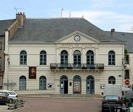
The town hall in Lormes | ||
| ||
 Lormes | ||
|
Location within Bourgogne-Franche-Comté region  Lormes | ||
| Coordinates: 47°17′27″N 3°49′06″E / 47.2908°N 3.8183°ECoordinates: 47°17′27″N 3°49′06″E / 47.2908°N 3.8183°E | ||
| Country | France | |
| Region | Bourgogne-Franche-Comté | |
| Department | Nièvre | |
| Arrondissement | Clamecy | |
| Canton | Lormes | |
| Intercommunality | Portes du Morvan | |
| Government | ||
| • Mayor (2008–2012) | Fabien Bazin | |
| Area1 | 51.71 km2 (19.97 sq mi) | |
| Population (1999)2 | 1,398 | |
| • Density | 27/km2 (70/sq mi) | |
| Time zone | CET (UTC+1) | |
| • Summer (DST) | CEST (UTC+2) | |
| INSEE/Postal code | 58145 / 58140 | |
| Elevation | 202–626 m (663–2,054 ft) | |
|
1 French Land Register data, which excludes lakes, ponds, glaciers > 1 km² (0.386 sq mi or 247 acres) and river estuaries. 2 Population without double counting: residents of multiple communes (e.g., students and military personnel) only counted once. | ||

Lormes is a commune in the Nièvre department in central France.
Demographics
At the 1999 census, the population was 1398. On 1 January 2004, the estimate was 1389.
See also
References
External links
- Lormes.net (Unofficial website) (French) (English) (Dutch)
- Lormes.fr (Official website) (French)
| Wikimedia Commons has media related to Lormes. |
This article is issued from Wikipedia - version of the 3/13/2015. The text is available under the Creative Commons Attribution/Share Alike but additional terms may apply for the media files.