Sauvigny-les-Bois
| Sauvigny-les-Bois | |
|---|---|
|
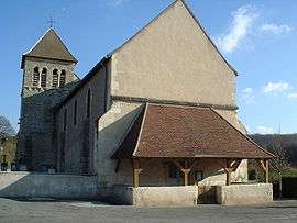
The church in Sauvigny-les-Bois | |
 Sauvigny-les-Bois | |
|
Location within Bourgogne-Franche-Comté region  Sauvigny-les-Bois | |
| Coordinates: 46°58′10″N 3°16′24″E / 46.9694°N 3.2733°ECoordinates: 46°58′10″N 3°16′24″E / 46.9694°N 3.2733°E | |
| Country | France |
| Region | Bourgogne-Franche-Comté |
| Department | Nièvre |
| Arrondissement | Nevers |
| Canton | Imphy |
| Intercommunality | Loire et Allier |
| Government | |
| • Mayor (2001–2008) | Bernard Gaget |
| Area1 | 29.64 km2 (11.44 sq mi) |
| Population (1999)2 | 1,527 |
| • Density | 52/km2 (130/sq mi) |
| Time zone | CET (UTC+1) |
| • Summer (DST) | CEST (UTC+2) |
| INSEE/Postal code | 58273 / 58160 |
| Elevation | 172–297 m (564–974 ft) |
|
1 French Land Register data, which excludes lakes, ponds, glaciers > 1 km² (0.386 sq mi or 247 acres) and river estuaries. 2 Population without double counting: residents of multiple communes (e.g., students and military personnel) only counted once. | |
Sauvigny-les-Bois is a commune in the Nièvre department in central France. It is located on the junction of the main D18 road with the D209, 9km south east of Nevers.
Demographics
At the 1999 census, the population was 1527. On 1 January 2006, the estimate was 1515.
See also
References
| Wikimedia Commons has media related to Sauvigny-les-Bois. |
This article is issued from Wikipedia - version of the 3/15/2016. The text is available under the Creative Commons Attribution/Share Alike but additional terms may apply for the media files.