Saint-Benin-des-Bois
| Saint-Benin-des-Bois | |
|---|---|
|
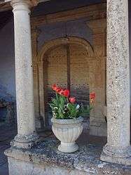
The entrance to the church in Saint-Benin-des-Bois | |
 Saint-Benin-des-Bois | |
|
Location within Bourgogne-Franche-Comté region  Saint-Benin-des-Bois | |
| Coordinates: 47°07′24″N 3°24′37″E / 47.1233°N 3.4103°ECoordinates: 47°07′24″N 3°24′37″E / 47.1233°N 3.4103°E | |
| Country | France |
| Region | Bourgogne-Franche-Comté |
| Department | Nièvre |
| Arrondissement | Nevers |
| Canton | Saint-Saulge |
| Intercommunality | Coeur du Nivernais |
| Area1 | 19.40 km2 (7.49 sq mi) |
| Population (2006)2 | 203 |
| • Density | 10/km2 (27/sq mi) |
| Time zone | CET (UTC+1) |
| • Summer (DST) | CEST (UTC+2) |
| INSEE/Postal code | 58233 / 58330 |
| Elevation | 248–444 m (814–1,457 ft) |
|
1 French Land Register data, which excludes lakes, ponds, glaciers > 1 km² (0.386 sq mi or 247 acres) and river estuaries. 2 Population without double counting: residents of multiple communes (e.g., students and military personnel) only counted once. | |
Saint-Benin-des-Bois is a commune in the Nièvre department in central France.
See also
References
| Wikimedia Commons has media related to Saint-Benin-des-Bois. |
This article is issued from Wikipedia - version of the 3/14/2015. The text is available under the Creative Commons Attribution/Share Alike but additional terms may apply for the media files.