Beaumont-la-Ferrière
| Beaumont-la-Ferrière | |
|---|---|
|
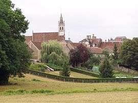
A general view of Beaumont-la-Ferrière | |
 Beaumont-la-Ferrière | |
|
Location within Bourgogne-Franche-Comté region  Beaumont-la-Ferrière | |
| Coordinates: 47°11′26″N 3°13′37″E / 47.1906°N 3.2269°ECoordinates: 47°11′26″N 3°13′37″E / 47.1906°N 3.2269°E | |
| Country | France |
| Region | Bourgogne-Franche-Comté |
| Department | Nièvre |
| Arrondissement | Cosne-Cours-sur-Loire |
| Canton | La Charité-sur-Loire |
| Intercommunality | Pays Charitois |
| Government | |
| • Mayor (2008–2014) | René Nicard |
| Area1 | 28.13 km2 (10.86 sq mi) |
| Population (2009)2 | 137 |
| • Density | 4.9/km2 (13/sq mi) |
| Time zone | CET (UTC+1) |
| • Summer (DST) | CEST (UTC+2) |
| INSEE/Postal code | 58027 / 58700 |
| Elevation | 211–324 m (692–1,063 ft) |
|
1 French Land Register data, which excludes lakes, ponds, glaciers > 1 km² (0.386 sq mi or 247 acres) and river estuaries. 2 Population without double counting: residents of multiple communes (e.g., students and military personnel) only counted once. | |
Beaumont-la-Ferrière is a commune in the Nièvre department in central France.
Population
| Historical population | ||
|---|---|---|
| Year | Pop. | ±% |
| 1962 | 124 | — |
| 1968 | 194 | +56.5% |
| 1975 | 189 | −2.6% |
| 1982 | 195 | +3.2% |
| 1990 | 157 | −19.5% |
| 1999 | 144 | −8.3% |
| 2006 | 138 | −4.2% |
| 2007 | 137 | −0.7% |
| 2009 | 137 | +0.0% |
See also
References
| Wikimedia Commons has media related to Beaumont-la-Ferrière. |
This article is issued from Wikipedia - version of the 9/17/2015. The text is available under the Creative Commons Attribution/Share Alike but additional terms may apply for the media files.