Beaulieu, Nièvre
For other uses, see Beaulieu.
| Beaulieu | ||
|---|---|---|
|
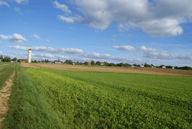
A general view of Beaulieu | ||
| ||
 Beaulieu | ||
|
Location within Bourgogne-Franche-Comté region  Beaulieu | ||
| Coordinates: 47°15′25″N 3°31′41″E / 47.2569°N 3.5281°ECoordinates: 47°15′25″N 3°31′41″E / 47.2569°N 3.5281°E | ||
| Country | France | |
| Region | Bourgogne-Franche-Comté | |
| Department | Nièvre | |
| Arrondissement | Clamecy | |
| Canton | Corbigny | |
| Intercommunality | Val du Beuvron | |
| Government | ||
| • Mayor (2008–2014) | Denis Soulier | |
| Area1 | 15.54 km2 (6.00 sq mi) | |
| Population (2013)2 | 164 | |
| • Density | 11/km2 (27/sq mi) | |
| Time zone | CET (UTC+1) | |
| • Summer (DST) | CEST (UTC+2) | |
| INSEE/Postal code | 58026 / 58420 | |
| Elevation | 218–296 m (715–971 ft) | |
|
1 French Land Register data, which excludes lakes, ponds, glaciers > 1 km² (0.386 sq mi or 247 acres) and river estuaries. 2 Population without double counting: residents of multiple communes (e.g., students and military personnel) only counted once. | ||

Beaulieu is a commune in the Nièvre department in central France. On 1 January 2016, the former communes Dompierre-sur-Héry and Michaugues were merged into Beaulieu.[1]
Population
| Historical population | ||
|---|---|---|
| Year | Pop. | ±% |
| 1820 | 222 | — |
| 1872 | 196 | −11.7% |
| 1881 | 171 | −12.8% |
| 1896 | 165 | −3.5% |
| 1901 | 147 | −10.9% |
| 1906 | 137 | −6.8% |
| 1911 | 133 | −2.9% |
| 1962 | 38 | −71.4% |
| 1968 | 51 | +34.2% |
| 1975 | 51 | +0.0% |
| 1982 | 59 | +15.7% |
| 1990 | 45 | −23.7% |
| 1999 | 44 | −2.2% |
| 2006 | 35 | −20.5% |
| 2009 | 32 | −8.6% |
See also
References
- ↑ Arrêté préfectoral 1 October 2015 (French)
| Wikimedia Commons has media related to Beaulieu (Nièvre). |
This article is issued from Wikipedia - version of the 2/12/2016. The text is available under the Creative Commons Attribution/Share Alike but additional terms may apply for the media files.