Anneyron
| Anneyron | ||
|---|---|---|
 | ||
| ||
 Anneyron | ||
|
Location within Auvergne-Rhône-Alpes region  Anneyron | ||
| Coordinates: 45°16′19″N 4°53′19″E / 45.2719°N 4.8886°ECoordinates: 45°16′19″N 4°53′19″E / 45.2719°N 4.8886°E | ||
| Country | France | |
| Region | Auvergne-Rhône-Alpes | |
| Department | Drôme | |
| Arrondissement | Valence | |
| Canton | Saint-Vallier | |
| Intercommunality | Rhône-Valloire | |
| Government | ||
| • Mayor (2008–2014) | Alain Genthon | |
| Area1 | 36.23 km2 (13.99 sq mi) | |
| Population (2008)2 | 3,737 | |
| • Density | 100/km2 (270/sq mi) | |
| Time zone | CET (UTC+1) | |
| • Summer (DST) | CEST (UTC+2) | |
| INSEE/Postal code | 26010 / 26140 | |
| Elevation |
165–372 m (541–1,220 ft) (avg. 210 m or 690 ft) | |
|
1 French Land Register data, which excludes lakes, ponds, glaciers > 1 km² (0.386 sq mi or 247 acres) and river estuaries. 2 Population without double counting: residents of multiple communes (e.g., students and military personnel) only counted once. | ||

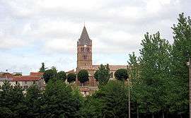
Anneyron is a commune in the Drôme department in southeastern France.
Population
| Historical population | ||
|---|---|---|
| Year | Pop. | ±% |
| 1821 | 2,082 | — |
| 1831 | 2,527 | +21.4% |
| 1841 | 2,891 | +14.4% |
| 1851 | 3,040 | +5.2% |
| 1861 | 3,122 | +2.7% |
| 1881 | 2,869 | −8.1% |
| 1911 | 2,530 | −11.8% |
| 1931 | 2,248 | −11.1% |
| 1962 | 2,519 | +12.1% |
| 1968 | 2,746 | +9.0% |
| 1975 | 2,895 | +5.4% |
| 1982 | 2,864 | −1.1% |
| 1990 | 3,038 | +6.1% |
| 1999 | 3,319 | +9.2% |
| 2008 | 3,737 | +12.6% |
See also
References
External links
| Wikimedia Commons has media related to Anneyron. |
This article is issued from Wikipedia - version of the 10/28/2016. The text is available under the Creative Commons Attribution/Share Alike but additional terms may apply for the media files.