Le Grand-Serre
| Le Grand-Serre | |
|---|---|
|
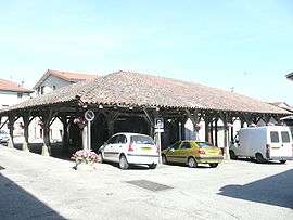
Medieval hall | |
 Le Grand-Serre | |
|
Location within Auvergne-Rhône-Alpes region  Le Grand-Serre | |
| Coordinates: 45°16′14″N 5°06′14″E / 45.2706°N 5.1039°ECoordinates: 45°16′14″N 5°06′14″E / 45.2706°N 5.1039°E | |
| Country | France |
| Region | Auvergne-Rhône-Alpes |
| Department | Drôme |
| Arrondissement | Valence |
| Canton | Le Grand-Serre |
| Government | |
| • Mayor (2014–2016) | Yann Lescot |
| Area1 | 24.74 km2 (9.55 sq mi) |
| Population (2008)2 | 793 |
| • Density | 32/km2 (83/sq mi) |
| Time zone | CET (UTC+1) |
| • Summer (DST) | CEST (UTC+2) |
| INSEE/Postal code | 26143 / 26530 |
| Elevation |
329–519 m (1,079–1,703 ft) (avg. 480 m or 1,570 ft) |
|
1 French Land Register data, which excludes lakes, ponds, glaciers > 1 km² (0.386 sq mi or 247 acres) and river estuaries. 2 Population without double counting: residents of multiple communes (e.g., students and military personnel) only counted once. | |
Le Grand-Serre is a commune in the Drôme department in southeastern France.
Geography
The Galaure flows west through the northern part of the commune, then forms part of its north-western border.
The nearest communes are Marcollin and Saint Clair sur Galaure.
Population
| Historical population | ||
|---|---|---|
| Year | Pop. | ±% |
| 1911 | 1,385 | — |
| 1962 | 773 | −44.2% |
| 1968 | 800 | +3.5% |
| 1975 | 702 | −12.3% |
| 1982 | 721 | +2.7% |
| 1990 | 722 | +0.1% |
| 1999 | 735 | +1.8% |
| 2008 | 793 | +7.9% |
Education
2 schools are located in the commune, a primary school and a high school.
Events
- Each year during summer is organized a party in the village called "La Vogue". Every village in Drôme does his own party that lasts 2 or 3 days.
See also
References
| Wikimedia Commons has media related to Le Grand-Serre. |
This article is issued from Wikipedia - version of the 11/14/2016. The text is available under the Creative Commons Attribution/Share Alike but additional terms may apply for the media files.