Sainte-Croix, Drôme
| Sainte-Croix | |
|---|---|
 | |
 Sainte-Croix | |
|
Location within Auvergne-Rhône-Alpes region  Sainte-Croix | |
| Coordinates: 44°46′09″N 5°17′02″E / 44.7692°N 5.2839°ECoordinates: 44°46′09″N 5°17′02″E / 44.7692°N 5.2839°E | |
| Country | France |
| Region | Auvergne-Rhône-Alpes |
| Department | Drôme |
| Arrondissement | Die |
| Canton | Die |
| Intercommunality | Diois |
| Government | |
| • Mayor (2008–2014) | Nathalie Nelis |
| Area1 | 10.78 km2 (4.16 sq mi) |
| Population (2008)2 | 89 |
| • Density | 8.3/km2 (21/sq mi) |
| Time zone | CET (UTC+1) |
| • Summer (DST) | CEST (UTC+2) |
| INSEE/Postal code | 26299 / 26150 |
| Elevation |
333–1,014 m (1,093–3,327 ft) (avg. 400 m or 1,300 ft) |
|
1 French Land Register data, which excludes lakes, ponds, glaciers > 1 km² (0.386 sq mi or 247 acres) and river estuaries. 2 Population without double counting: residents of multiple communes (e.g., students and military personnel) only counted once. | |
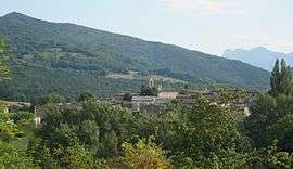
Sainte-Croix is a commune in the Drôme department in southeastern France.
Population
| Historical population | ||
|---|---|---|
| Year | Pop. | ±% |
| 1911 | 280 | — |
| 1962 | 79 | −71.8% |
| 1968 | 110 | +39.2% |
| 1975 | 90 | −18.2% |
| 1982 | 92 | +2.2% |
| 1990 | 102 | +10.9% |
| 1999 | 90 | −11.8% |
| 2008 | 98 | +8.9% |
See also
References
External links
| Wikimedia Commons has media related to Sainte-Croix (Drôme). |
This article is issued from Wikipedia - version of the 10/28/2016. The text is available under the Creative Commons Attribution/Share Alike but additional terms may apply for the media files.