Mours-Saint-Eusèbe
| Mours-Saint-Eusèbe | |
|---|---|
|
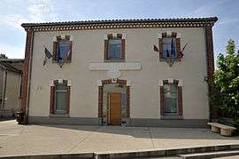
Town hall | |
 Mours-Saint-Eusèbe | |
|
Location within Auvergne-Rhône-Alpes region  Mours-Saint-Eusèbe | |
| Coordinates: 45°04′20″N 5°03′07″E / 45.0722°N 5.0519°ECoordinates: 45°04′20″N 5°03′07″E / 45.0722°N 5.0519°E | |
| Country | France |
| Region | Auvergne-Rhône-Alpes |
| Department | Drôme |
| Arrondissement | Valence |
| Canton | Romans-sur-Isère-1 |
| Intercommunality | Pays de Romans |
| Government | |
| • Mayor (2008–2014) | Alain Vallet |
| Area1 | 5.27 km2 (2.03 sq mi) |
| Population (2008)2 | 2,478 |
| • Density | 470/km2 (1,200/sq mi) |
| Time zone | CET (UTC+1) |
| • Summer (DST) | CEST (UTC+2) |
| INSEE/Postal code | 26218 / 26540 |
| Elevation |
173–318 m (568–1,043 ft) (avg. 171 m or 561 ft) |
|
1 French Land Register data, which excludes lakes, ponds, glaciers > 1 km² (0.386 sq mi or 247 acres) and river estuaries. 2 Population without double counting: residents of multiple communes (e.g., students and military personnel) only counted once. | |
Mours-Saint-Eusèbe is a commune in the Drôme department in southeastern France.
Population
| Historical population | ||
|---|---|---|
| Year | Pop. | ±% |
| 1911 | 518 | — |
| 1962 | 825 | +59.3% |
| 1968 | 988 | +19.8% |
| 1975 | 1,348 | +36.4% |
| 1982 | 1,839 | +36.4% |
| 1990 | 2,027 | +10.2% |
| 1999 | 2,186 | +7.8% |
| 2008 | 2,478 | +13.4% |
See also
References
| Wikimedia Commons has media related to Mours-Saint-Eusèbe. |
This article is issued from Wikipedia - version of the 10/28/2016. The text is available under the Creative Commons Attribution/Share Alike but additional terms may apply for the media files.