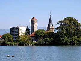
La Roche-de-Glun
| La Roche de Glun | ||
|---|---|---|
 | ||
| ||
 La Roche de Glun | ||
|
Location within Auvergne-Rhône-Alpes region  La Roche de Glun | ||
| Coordinates: 45°00′46″N 4°50′54″E / 45.0128°N 4.8483°ECoordinates: 45°00′46″N 4°50′54″E / 45.0128°N 4.8483°E | ||
| Country | France | |
| Region | Auvergne-Rhône-Alpes | |
| Department | Drôme | |
| Arrondissement | Valence | |
| Canton | Tain-l'Hermitage | |
| Intercommunality | Pays de l'Hermitage | |
| Government | ||
| • Mayor (2008–2014) | Hervé Chaboud | |
| Area1 | 12.79 km2 (4.94 sq mi) | |
| Population (2008)2 | 3,154 | |
| • Density | 250/km2 (640/sq mi) | |
| Time zone | CET (UTC+1) | |
| • Summer (DST) | CEST (UTC+2) | |
| INSEE/Postal code | 26271 / 26600 | |
| Elevation |
103–147 m (338–482 ft) (avg. 119 m or 390 ft) | |
|
1 French Land Register data, which excludes lakes, ponds, glaciers > 1 km² (0.386 sq mi or 247 acres) and river estuaries. 2 Population without double counting: residents of multiple communes (e.g., students and military personnel) only counted once. | ||
.svg.png)
La Roche-de-Glun is a commune in the Drôme department in southeastern France.
Population
| Historical population | ||
|---|---|---|
| Year | Pop. | ±% |
| 1911 | 900 | — |
| 1962 | 880 | −2.2% |
| 1968 | 1,227 | +39.4% |
| 1975 | 1,467 | +19.6% |
| 1982 | 2,113 | +44.0% |
| 1990 | 2,800 | +32.5% |
| 1999 | 2,740 | −2.1% |
| 2008 | 3,154 | +15.1% |
See also
References
| Wikimedia Commons has media related to La Roche-de-Glun. |
This article is issued from Wikipedia - version of the 2/11/2016. The text is available under the Creative Commons Attribution/Share Alike but additional terms may apply for the media files.