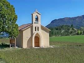
Mévouillon
| Mévouillon | ||
|---|---|---|
 | ||
| ||
 Mévouillon | ||
|
Location within Auvergne-Rhône-Alpes region  Mévouillon | ||
| Coordinates: 44°14′33″N 5°27′54″E / 44.2425°N 5.465°ECoordinates: 44°14′33″N 5°27′54″E / 44.2425°N 5.465°E | ||
| Country | France | |
| Region | Auvergne-Rhône-Alpes | |
| Department | Drôme | |
| Arrondissement | Nyons | |
| Canton | Séderon | |
| Intercommunality | Hautes Baronnies | |
| Government | ||
| • Mayor (2008–2014) | Gérard Gozzi | |
| Area1 | 29.09 km2 (11.23 sq mi) | |
| Population (2008)2 | 213 | |
| • Density | 7.3/km2 (19/sq mi) | |
| Time zone | CET (UTC+1) | |
| • Summer (DST) | CEST (UTC+2) | |
| INSEE/Postal code | 26181 / 26560 | |
| Elevation |
780–1,440 m (2,560–4,720 ft) (avg. 840 m or 2,760 ft) | |
|
1 French Land Register data, which excludes lakes, ponds, glaciers > 1 km² (0.386 sq mi or 247 acres) and river estuaries. 2 Population without double counting: residents of multiple communes (e.g., students and military personnel) only counted once. | ||
.svg.png)
Mévouillon is a commune in the Drôme department in southeastern France.
Population
| Historical population | ||
|---|---|---|
| Year | Pop. | ±% |
| 1911 | 652 | — |
| 1962 | 323 | −50.5% |
| 1968 | 283 | −12.4% |
| 1975 | 263 | −7.1% |
| 1982 | 233 | −11.4% |
| 1990 | 206 | −11.6% |
| 1999 | 204 | −1.0% |
| 2008 | 213 | +4.4% |
See also
References
| Wikimedia Commons has media related to Mévouillon. |
This article is issued from Wikipedia - version of the 2/11/2016. The text is available under the Creative Commons Attribution/Share Alike but additional terms may apply for the media files.