Barbières
| Barbières | |
|---|---|
|
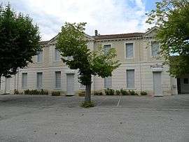
Town hall | |
 Barbières | |
|
Location within Auvergne-Rhône-Alpes region  Barbières | |
| Coordinates: 44°57′26″N 5°08′29″E / 44.9572°N 5.1414°ECoordinates: 44°57′26″N 5°08′29″E / 44.9572°N 5.1414°E | |
| Country | France |
| Region | Auvergne-Rhône-Alpes |
| Department | Drôme |
| Arrondissement | Valence |
| Canton | Bourg-de-Péage |
| Intercommunality | Canton de Bourg-de-Péage |
| Government | |
| • Mayor (2008–2014) | Michel Bénistant |
| Area1 | 14.4 km2 (5.6 sq mi) |
| Population (2008)2 | 766 |
| • Density | 53/km2 (140/sq mi) |
| Time zone | CET (UTC+1) |
| • Summer (DST) | CEST (UTC+2) |
| INSEE/Postal code | 26023 / 26300 |
| Elevation | 389–1,322 m (1,276–4,337 ft) |
|
1 French Land Register data, which excludes lakes, ponds, glaciers > 1 km² (0.386 sq mi or 247 acres) and river estuaries. 2 Population without double counting: residents of multiple communes (e.g., students and military personnel) only counted once. | |
Barbières is a commune in the Drôme department in southeastern France.
Population
| Historical population | ||
|---|---|---|
| Year | Pop. | ±% |
| 1911 | 422 | — |
| 1962 | 433 | +2.6% |
| 1968 | 519 | +19.9% |
| 1975 | 534 | +2.9% |
| 1982 | 610 | +14.2% |
| 1990 | 583 | −4.4% |
| 1999 | 647 | +11.0% |
| 2008 | 766 | +18.4% |
See also
References
| Wikimedia Commons has media related to Barbières. |
This article is issued from Wikipedia - version of the 7/21/2016. The text is available under the Creative Commons Attribution/Share Alike but additional terms may apply for the media files.