Beauregard-Baret
| Beauregard-Baret | ||
|---|---|---|
 | ||
| ||
 Beauregard-Baret | ||
|
Location within Auvergne-Rhône-Alpes region  Beauregard-Baret | ||
| Coordinates: 45°01′00″N 5°09′07″E / 45.0167°N 5.1519°ECoordinates: 45°01′00″N 5°09′07″E / 45.0167°N 5.1519°E | ||
| Country | France | |
| Region | Auvergne-Rhône-Alpes | |
| Department | Drôme | |
| Arrondissement | Valence | |
| Canton | Bourg-de-Péage | |
| Intercommunality | Bourg-de-Péage | |
| Government | ||
| • Mayor (2008–2014) | Lionel Fournat | |
| Area1 | 23.44 km2 (9.05 sq mi) | |
| Population (2008)2 | 784 | |
| • Density | 33/km2 (87/sq mi) | |
| Time zone | CET (UTC+1) | |
| • Summer (DST) | CEST (UTC+2) | |
| INSEE/Postal code | 26039 / 26300 | |
| Elevation | 141–1,292 m (463–4,239 ft) | |
|
1 French Land Register data, which excludes lakes, ponds, glaciers > 1 km² (0.386 sq mi or 247 acres) and river estuaries. 2 Population without double counting: residents of multiple communes (e.g., students and military personnel) only counted once. | ||
.svg.png)
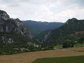
Beauregard-Baret is a commune in the Drôme department in southeastern France.
Population
| Historical population | ||
|---|---|---|
| Year | Pop. | ±% |
| 1790 | 1,560 | — |
| 1793 | 1,400 | −10.3% |
| 1800 | 1,376 | −1.7% |
| 1806 | 1,570 | +14.1% |
| 1821 | 1,651 | +5.2% |
| 1831 | 1,636 | −0.9% |
| 1836 | 1,622 | −0.9% |
| 1841 | 1,679 | +3.5% |
| 1851 | 1,665 | −0.8% |
| 1856 | 1,676 | +0.7% |
| 1861 | 1,715 | +2.3% |
| 1866 | 1,630 | −5.0% |
| 1872 | 1,573 | −3.5% |
| 1876 | 1,568 | −0.3% |
| 1881 | 1,392 | −11.2% |
| 1886 | 1,342 | −3.6% |
| 1891 | 1,284 | −4.3% |
| 1896 | 1,231 | −4.1% |
| 1901 | 1,250 | +1.5% |
| 1906 | 1,170 | −6.4% |
| 1911 | 1,109 | −5.2% |
| 1921 | 944 | −14.9% |
| 1926 | 886 | −6.1% |
| 1931 | 882 | −0.5% |
| 1936 | 816 | −7.5% |
| 1946 | 861 | +5.5% |
| 1954 | 415 | −51.8% |
| 1962 | 441 | +6.3% |
| 1968 | 364 | −17.5% |
| 1975 | 321 | −11.8% |
| 1982 | 429 | +33.6% |
| 1990 | 504 | +17.5% |
| 1999 | 543 | +7.7% |
| 2008 | 784 | +44.4% |
See also
References
External links
| Wikimedia Commons has media related to Beauregard-Baret. |
This article is issued from Wikipedia - version of the 10/28/2016. The text is available under the Creative Commons Attribution/Share Alike but additional terms may apply for the media files.