Cervens
| Cervens | ||
|---|---|---|
|
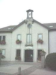
Town hall | ||
| ||
 Cervens | ||
|
Location within Auvergne-Rhône-Alpes region  Cervens | ||
| Coordinates: 46°17′12″N 6°26′32″E / 46.2867°N 6.4422°ECoordinates: 46°17′12″N 6°26′32″E / 46.2867°N 6.4422°E | ||
| Country | France | |
| Region | Auvergne-Rhône-Alpes | |
| Department | Haute-Savoie | |
| Arrondissement | Arrondissement of Thonon-les-Bains | |
| Canton | Canton of Thonon-les-Bains-Ouest | |
| Intercommunality | Communauté de communes des Collines du Léman | |
| Government | ||
| • Mayor (2008–2014) | Gil Thomas | |
| Area1 | 6.36 km2 (2.46 sq mi) | |
| Population (1999)2 | 729 | |
| • Density | 110/km2 (300/sq mi) | |
| Time zone | CET (UTC+1) | |
| • Summer (DST) | CEST (UTC+2) | |
| INSEE/Postal code | 74053 / 74550 | |
| Elevation | 565–1,230 m (1,854–4,035 ft) | |
|
1 French Land Register data, which excludes lakes, ponds, glaciers > 1 km² (0.386 sq mi or 247 acres) and river estuaries. 2 Population without double counting: residents of multiple communes (e.g., students and military personnel) only counted once. | ||

Cervens is a commune in the Haute-Savoie department in the Auvergne-Rhône-Alpes region in south-eastern France.
See also
References
| Wikimedia Commons has media related to Cervens. |
This article is issued from Wikipedia - version of the 10/28/2016. The text is available under the Creative Commons Attribution/Share Alike but additional terms may apply for the media files.