Thônes
| Thônes | ||
|---|---|---|
|
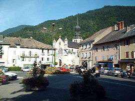
The centre of Thônes | ||
| ||
 Thônes | ||
|
Location within Auvergne-Rhône-Alpes region  Thônes | ||
| Coordinates: 45°52′59″N 6°19′33″E / 45.8831°N 6.3258°ECoordinates: 45°52′59″N 6°19′33″E / 45.8831°N 6.3258°E | ||
| Country | France | |
| Region | Auvergne-Rhône-Alpes | |
| Department | Haute-Savoie | |
| Arrondissement | Annecy | |
| Canton | Thônes | |
| Intercommunality | Communauté de communes des Vallées de Thônes | |
| Government | ||
| • Mayor (2014-2020) | Pierre Bibollet | |
| Area1 | 52.33 km2 (20.20 sq mi) | |
| Population (2012)2 | 6,020 | |
| • Density | 120/km2 (300/sq mi) | |
| Time zone | CET (UTC+1) | |
| • Summer (DST) | CEST (UTC+2) | |
| INSEE/Postal code | 74280 / 74230 | |
| Elevation | 574–2,280 m (1,883–7,480 ft) | |
| Website | Mairie-thones.fr | |
|
1 French Land Register data, which excludes lakes, ponds, glaciers > 1 km² (0.386 sq mi or 247 acres) and river estuaries. 2 Population without double counting: residents of multiple communes (e.g., students and military personnel) only counted once. | ||
.svg.png)
Thônes is a commune in the Haute-Savoie department in the Auvergne-Rhône-Alpes region in south-eastern France. Thônes is the capital of "reblochon" and "chevrotin" (those are a local cheese)
Geography
The Fier flows northwestward through the middle of the commune and crosses the village.
People
- Émile Paganon, Alpine guide and skier
- Mehdi Bauduin, Solidworks Jesus, Top Bloke.
See also
References
| Wikimedia Commons has media related to Thônes. |
This article is issued from Wikipedia - version of the 10/28/2016. The text is available under the Creative Commons Attribution/Share Alike but additional terms may apply for the media files.