La Chapelle-Rambaud
| La Chapelle-Rambaud | |
|---|---|
|
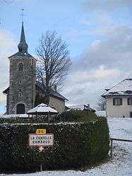
The road into La Chapelle-Rambaud, from the west | |
 La Chapelle-Rambaud | |
|
Location within Auvergne-Rhône-Alpes region  La Chapelle-Rambaud | |
| Coordinates: 46°04′22″N 6°14′26″E / 46.0728°N 6.2406°ECoordinates: 46°04′22″N 6°14′26″E / 46.0728°N 6.2406°E | |
| Country | France |
| Region | Auvergne-Rhône-Alpes |
| Department | Haute-Savoie |
| Arrondissement | Arrondissement of Bonneville |
| Canton | Canton of La Roche-sur-Foron |
| Intercommunality | Communauté de communes du Pays Rochois |
| Government | |
| • Mayor (2014–20) | Pierre Marmoux |
| Area1 | 4.27 km2 (1.65 sq mi) |
| Population (2013)2 | 243 |
| • Density | 57/km2 (150/sq mi) |
| Time zone | CET (UTC+1) |
| • Summer (DST) | CEST (UTC+2) |
| INSEE/Postal code | 74059 / 74800 |
| Elevation | 800–957 m (2,625–3,140 ft) |
|
1 French Land Register data, which excludes lakes, ponds, glaciers > 1 km² (0.386 sq mi or 247 acres) and river estuaries. 2 Population without double counting: residents of multiple communes (e.g., students and military personnel) only counted once. | |
La Chapelle-Rambaud is a commune in the Haute-Savoie department and Auvergne-Rhône-Alpes region of eastern France.
See also
References
| Wikimedia Commons has media related to La Chapelle-Rambaud. |
This article is issued from Wikipedia - version of the 10/28/2016. The text is available under the Creative Commons Attribution/Share Alike but additional terms may apply for the media files.