Vallières, Haute-Savoie
| Vallières | |
|---|---|
|
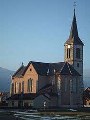
Church | |
 Vallières | |
|
Location within Auvergne-Rhône-Alpes region  Vallières | |
| Coordinates: 45°54′03″N 5°56′13″E / 45.9008°N 5.9369°ECoordinates: 45°54′03″N 5°56′13″E / 45.9008°N 5.9369°E | |
| Country | France |
| Region | Auvergne-Rhône-Alpes |
| Department | Haute-Savoie |
| Arrondissement | Arrondissement of Annecy |
| Canton | Canton of Rumilly |
| Intercommunality | Communauté de communes du Canton de Rumilly |
| Government | |
| • Mayor (2008–2014) | François Ravoire |
| Area1 | 9.03 km2 (3.49 sq mi) |
| Population (2006)2 | 1,382 |
| • Density | 150/km2 (400/sq mi) |
| • Urban | 25,728 |
| Time zone | CET (UTC+1) |
| • Summer (DST) | CEST (UTC+2) |
| INSEE/Postal code | 74289 / 74150 |
| Elevation | 299–510 m (981–1,673 ft) |
|
1 French Land Register data, which excludes lakes, ponds, glaciers > 1 km² (0.386 sq mi or 247 acres) and river estuaries. 2 Population without double counting: residents of multiple communes (e.g., students and military personnel) only counted once. | |
Vallières is a commune of 1 384 inhabitants in the Haute-Savoie department in the Auvergne-Rhône-Alpes region in south-eastern France.
Mayor
The current mayor is François Ravoire.
Geography
The Fier forms the commune's southern border.
See also
References
| Wikimedia Commons has media related to Vallières (Haute-Savoie). |
This article is issued from Wikipedia - version of the 10/28/2016. The text is available under the Creative Commons Attribution/Share Alike but additional terms may apply for the media files.