Saint-Jean-de-Sixt
| Saint-Jean-de-Sixt | |
|---|---|
|
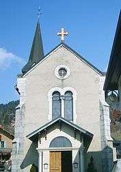
The church in Saint-Jean-de-Sixt | |
 Saint-Jean-de-Sixt | |
|
Location within Auvergne-Rhône-Alpes region  Saint-Jean-de-Sixt | |
| Coordinates: 45°55′26″N 6°24′38″E / 45.9239°N 6.4106°ECoordinates: 45°55′26″N 6°24′38″E / 45.9239°N 6.4106°E | |
| Country | France |
| Region | Auvergne-Rhône-Alpes |
| Department | Haute-Savoie |
| Arrondissement | Annecy |
| Canton | Thônes |
| Intercommunality | Vallées de Thônes |
| Government | |
| • Mayor (2001–2008) | Pierre Contat |
| Area1 | 12.21 km2 (4.71 sq mi) |
| Population (2006)2 | 1,266 |
| • Density | 100/km2 (270/sq mi) |
| Time zone | CET (UTC+1) |
| • Summer (DST) | CEST (UTC+2) |
| INSEE/Postal code | 74239 / 74450 |
| Elevation |
828–1,860 m (2,717–6,102 ft) (avg. 963 m or 3,159 ft) |
|
1 French Land Register data, which excludes lakes, ponds, glaciers > 1 km² (0.386 sq mi or 247 acres) and river estuaries. 2 Population without double counting: residents of multiple communes (e.g., students and military personnel) only counted once. | |
Saint-Jean-de-Sixt is a commune in the Haute-Savoie department in the Auvergne-Rhône-Alpes region in southeastern France.
It lies in the Aravis Range of the French Alps. The inhabitants are the Saintjeandais or Saintjeandins.
The village used to be called Villaret, when it was a part of the Kingdom of Savoy, prior to its incorporation into France in 1860.
Nearby
Nearby villages include Manigod, Thônes, Le Grand Bornand, La Clusaz and the larger Chamonix and Annecy.
Notable inhabitants
- Saint Peter Faber, S.J., one of the founders of the Jesuit Order, was born here.
See also
References
External links
| Wikimedia Commons has media related to Saint-Jean-de-Sixt. |
This article is issued from Wikipedia - version of the 10/28/2016. The text is available under the Creative Commons Attribution/Share Alike but additional terms may apply for the media files.