Jumel
| Jumel | |
|---|---|
 | |
 Jumel | |
|
Location within Hauts-de-France region  Jumel | |
| Coordinates: 49°45′34″N 2°21′09″E / 49.7594°N 2.3525°E / 49.7594; 2.3525Coordinates: 49°45′34″N 2°21′09″E / 49.7594°N 2.3525°E / 49.7594; 2.3525 | |
| Country | France |
| Region | Hauts-de-France |
| Department | Somme |
| Arrondissement | Montdidier |
| Canton | Ailly-sur-Noye |
| Intercommunality | Val de Noye |
| Government | |
| • Mayor (2001–2008) | Hubert Van Goethem |
| Area1 | 8.89 km2 (3.43 sq mi) |
| Population (2006)2 | 364 |
| • Density | 41/km2 (110/sq mi) |
| Time zone | CET (UTC+1) |
| • Summer (DST) | CEST (UTC+2) |
| INSEE/Postal code | 80452 / 80250 |
| Elevation |
48–135 m (157–443 ft) (avg. 65 m or 213 ft) |
|
1 French Land Register data, which excludes lakes, ponds, glaciers > 1 km² (0.386 sq mi or 247 acres) and river estuaries. 2 Population without double counting: residents of multiple communes (e.g., students and military personnel) only counted once. | |
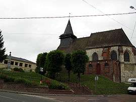
Jumel is a commune in the Somme department in Hauts-de-France in northern France.
Geography
Jumel is situated on the D7 and D920 junction, by the banks of the river Noye, some 10 miles (16 km) south of Amiens.
Population
| Year | 1962 | 1968 | 1975 | 1982 | 1990 | 1999 | 2006 |
|---|---|---|---|---|---|---|---|
| Population | 284 | 322 | 291 | 268 | 303 | 368 | 364 |
| From the year 1962 on: No double counting—residents of multiple communes (e.g. students and military personnel) are counted only once. | |||||||
See also
References
External links
| Wikimedia Commons has media related to Jumel. |
- Jumel on the Quid website (French)
This article is issued from Wikipedia - version of the 11/8/2016. The text is available under the Creative Commons Attribution/Share Alike but additional terms may apply for the media files.