Franqueville, Somme
| Franqueville | |
|---|---|
 | |
 Franqueville | |
|
Location within Hauts-de-France region  Franqueville | |
| Coordinates: 50°05′42″N 2°06′28″E / 50.095°N 2.1078°E / 50.095; 2.1078Coordinates: 50°05′42″N 2°06′28″E / 50.095°N 2.1078°E / 50.095; 2.1078 | |
| Country | France |
| Region | Hauts-de-France |
| Department | Somme |
| Arrondissement | Amiens |
| Canton | Domart-en-Ponthieu |
| Government | |
| • Mayor (2001–2008) | Daniel Gorrea |
| Area1 | 6.26 km2 (2.42 sq mi) |
| Population (2006)2 | 172 |
| • Density | 27/km2 (71/sq mi) |
| Time zone | CET (UTC+1) |
| • Summer (DST) | CEST (UTC+2) |
| INSEE/Postal code | 80346 / 80620 |
| Elevation |
53–127 m (174–417 ft) (avg. 69 m or 226 ft) |
|
1 French Land Register data, which excludes lakes, ponds, glaciers > 1 km² (0.386 sq mi or 247 acres) and river estuaries. 2 Population without double counting: residents of multiple communes (e.g., students and military personnel) only counted once. | |
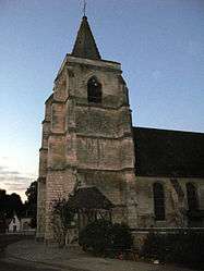
Franqueville is a commune in the Somme department in Hauts-de-France in northern France.
Geography
Franqueville is situated on the D130 road, some 16 miles (26 km) east of Abbeville.
Population
| Year | 1962 | 1968 | 1975 | 1982 | 1990 | 1999 | 2006 |
|---|---|---|---|---|---|---|---|
| Population | 105 | 120 | 98 | 87 | 97 | 108 | 172 |
| From the year 1962 on: No double counting—residents of multiple communes (e.g. students and military personnel) are counted only once. | |||||||
See also
References
External links
| Wikimedia Commons has media related to Franqueville (Somme). |
- Franqueville on the Quid website (French)
This article is issued from Wikipedia - version of the 11/8/2016. The text is available under the Creative Commons Attribution/Share Alike but additional terms may apply for the media files.