Quesnoy-sur-Airaines
| Quesnoy-sur-Airaines | |
|---|---|
|
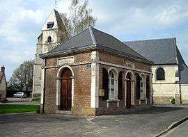
Town hall | |
 Quesnoy-sur-Airaines | |
|
Location within Hauts-de-France region  Quesnoy-sur-Airaines | |
| Coordinates: 49°57′24″N 1°59′30″E / 49.9567°N 1.9917°E / 49.9567; 1.9917Coordinates: 49°57′24″N 1°59′30″E / 49.9567°N 1.9917°E / 49.9567; 1.9917 | |
| Country | France |
| Region | Hauts-de-France |
| Department | Somme |
| Arrondissement | Amiens |
| Canton | Molliens-Dreuil |
| Intercommunality | Sud-Ouest Amiénois |
| Government | |
| • Mayor (2001–2008) | Jean-Marie Snauwaert |
| Area1 | 16.14 km2 (6.23 sq mi) |
| Population (2006)2 | 480 |
| • Density | 30/km2 (77/sq mi) |
| Time zone | CET (UTC+1) |
| • Summer (DST) | CEST (UTC+2) |
| INSEE/Postal code | 80655 / 80270 |
| Elevation |
50–124 m (164–407 ft) (avg. 80 m or 260 ft) |
|
1 French Land Register data, which excludes lakes, ponds, glaciers > 1 km² (0.386 sq mi or 247 acres) and river estuaries. 2 Population without double counting: residents of multiple communes (e.g., students and military personnel) only counted once. | |
Quesnoy-sur-Airaines is a commune in the Somme department in Hauts-de-France in northern France.
Geography
The commune is situated on the D936 road, some 14 miles (23 km) northwest of Amiens.
Population
| 1962 | 1968 | 1975 | 1982 | 1990 | 1999 | 2006 |
|---|---|---|---|---|---|---|
| 433 | 444 | 452 | 433 | 438 | 444 | 480 |
| Starting in 1962: Population without duplicates | ||||||
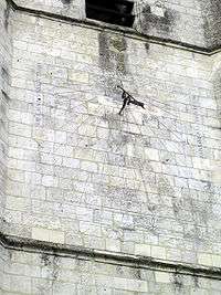
The sundial on the church
See also
References
External links
| Wikimedia Commons has media related to Quesnoy-sur-Airaines. |
This article is issued from Wikipedia - version of the 11/8/2016. The text is available under the Creative Commons Attribution/Share Alike but additional terms may apply for the media files.