Boves, Somme
| Boves | |
|---|---|
 Boves | |
|
Location within Hauts-de-France region  Boves | |
| Coordinates: 49°50′46″N 2°23′30″E / 49.8461°N 2.3917°ECoordinates: 49°50′46″N 2°23′30″E / 49.8461°N 2.3917°E | |
| Country | France |
| Region | Hauts-de-France |
| Department | Somme |
| Arrondissement | Amiens |
| Canton | Boves |
| Intercommunality | Amiens Métropole |
| Government | |
| • Mayor (2001–2008) | Patrick Lefevre |
| Area1 | 25.37 km2 (9.80 sq mi) |
| Population (2010)2 | 2,976 |
| • Density | 120/km2 (300/sq mi) |
| Time zone | CET (UTC+1) |
| • Summer (DST) | CEST (UTC+2) |
| INSEE/Postal code | 80131 / 80440 |
| Elevation |
22–110 m (72–361 ft) (avg. 28 m or 92 ft) |
|
1 French Land Register data, which excludes lakes, ponds, glaciers > 1 km² (0.386 sq mi or 247 acres) and river estuaries. 2 Population without double counting: residents of multiple communes (e.g., students and military personnel) only counted once. | |
Boves is a commune in the Somme department in Hauts-de-France in northern France.
Geography
Boves is situated on the D935 and D116 road junction, on the banks of the river Avre, some 5 miles (8 km) southeast of Amiens.
Population
| Year | 1962 | 1968 | 1975 | 1982 | 1990 | 1999 | 2006 |
|---|---|---|---|---|---|---|---|
| Population | 1826 | 1995 | 2266 | 3146 | 2964 | 2786 | 2678 |
| From the year 1962 on: No double counting—residents of multiple communes (e.g. students and military personnel) are counted only once. | |||||||
History
- c640 : The birthplace of Saint Godeberta
- c1166 : The birthplace of medieval author Jean de Boves.
- July 1185 : Philippe-Auguste signed the treaty acquiring part of Picardy.[1]
- August 1835 : Victor Hugo visited the ruins of the château.
Places of interest
- Ruins of the fortified 12th-century château
- Notre-Dame de la Nativité church
- ‘’Saint-Ladre’’ marshland nature reserve
See also
References
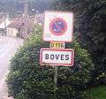 The sign at the entrance to the village
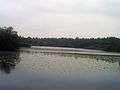 Lake Saint-Ladre
_1.jpg) The church, built at the foot of the chalk cliffs.
The church, built at the foot of the chalk cliffs..jpg) Rue Victor Hugo, the main street
Rue Victor Hugo, the main street
External links
| Wikimedia Commons has media related to Boves. |
This article is issued from Wikipedia - version of the 11/8/2016. The text is available under the Creative Commons Attribution/Share Alike but additional terms may apply for the media files.