Estrées-lès-Crécy
For other places of the same name, see Estrées.
| Estrées-lès-Crécy | |
|---|---|
 Estrées-lès-Crécy | |
|
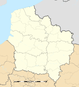
Location within Hauts-de-France region  Estrées-lès-Crécy | |
| Coordinates: 50°15′14″N 1°55′45″E / 50.2539°N 1.9292°ECoordinates: 50°15′14″N 1°55′45″E / 50.2539°N 1.9292°E | |
| Country | France |
| Region | Hauts-de-France |
| Department | Somme |
| Arrondissement | Abbeville |
| Canton | Crécy-en-Ponthieu |
| Government | |
| • Mayor (2001–2008) | Christiane Delannoy |
| Area1 | 11.19 km2 (4.32 sq mi) |
| Population (2006)2 | 380 |
| • Density | 34/km2 (88/sq mi) |
| Time zone | CET (UTC+1) |
| • Summer (DST) | CEST (UTC+2) |
| INSEE/Postal code | 80290 / 80150 |
| Elevation |
33–84 m (108–276 ft) (avg. 75 m or 246 ft) |
|
1 French Land Register data, which excludes lakes, ponds, glaciers > 1 km² (0.386 sq mi or 247 acres) and river estuaries. 2 Population without double counting: residents of multiple communes (e.g., students and military personnel) only counted once. | |
Estrées-lès-Crécy is a commune in the Somme department in Hauts-de-France in northern France.
Geography
The commune is situated on the D938 road, near the site of the Battle of Crecy, 16 kilometres (10 mi) north of Abbeville.
Railway
There was a railway station (Crécy-Estrées) on the branch of the Réseau des Bains de Mer which ran between Abbeville and Dompierre-sur-Authie. It opened on 19 June 1892 and closed to passengers on 10 March 1947. It closed to freight on 1 February 1951.
Population
| Year | 1962 | 1968 | 1975 | 1982 | 1990 | 1999 | 2006 |
|---|---|---|---|---|---|---|---|
| Population | 368 | 406 | 380 | 358 | 353 | 362 | 380 |
| From the year 1962 on: No double counting—residents of multiple communes (e.g. students and military personnel) are counted only once. | |||||||
See also
References
External links
| Wikimedia Commons has media related to Estrées-lès-Crécy. |
This article is issued from Wikipedia - version of the 11/8/2016. The text is available under the Creative Commons Attribution/Share Alike but additional terms may apply for the media files.