Coyolles
| Coyolles | |
|---|---|
|
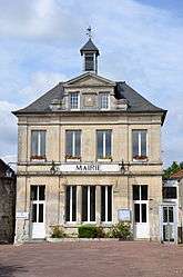
Town hall | |
 Coyolles | |
|
Location within Hauts-de-France region  Coyolles | |
| Coordinates: 49°14′06″N 3°02′40″E / 49.235°N 3.0444°ECoordinates: 49°14′06″N 3°02′40″E / 49.235°N 3.0444°E | |
| Country | France |
| Region | Hauts-de-France |
| Department | Aisne |
| Arrondissement | Soissons |
| Canton | Villers-Cotterêts |
| Government | |
| • Mayor (2008–2014) | Marc Charles |
| Area1 | 24.55 km2 (9.48 sq mi) |
| Population (2008)2 | 352 |
| • Density | 14/km2 (37/sq mi) |
| Time zone | CET (UTC+1) |
| • Summer (DST) | CEST (UTC+2) |
| INSEE/Postal code | 02232 / 02600 |
| Elevation |
72–170 m (236–558 ft) (avg. 109 m or 358 ft) |
|
1 French Land Register data, which excludes lakes, ponds, glaciers > 1 km² (0.386 sq mi or 247 acres) and river estuaries. 2 Population without double counting: residents of multiple communes (e.g., students and military personnel) only counted once. | |
Coyolles is a commune in the Aisne department in Hauts-de-France in northern France.
Population
| Historical population | ||
|---|---|---|
| Year | Pop. | ±% |
| 1962 | 226 | — |
| 1968 | 212 | −6.2% |
| 1975 | 212 | +0.0% |
| 1982 | 323 | +52.4% |
| 1990 | 370 | +14.6% |
| 1999 | 359 | −3.0% |
| 2008 | 352 | −1.9% |
Transportation
The closest airport to Coyolles is Paris Charles de Gaulle Airport (43 km) slightly further afield are Beauvais-Tillé Airport (72 km), Paris Orly Airport (75 km), or Lille Airport (148 km).[1]
See also
References
| Wikimedia Commons has media related to Coyolles. |
This article is issued from Wikipedia - version of the 11/8/2016. The text is available under the Creative Commons Attribution/Share Alike but additional terms may apply for the media files.