Craonne
| Craonne | ||
|---|---|---|
 | ||
| ||
 Craonne | ||
|
Location within Hauts-de-France region  Craonne | ||
| Coordinates: 49°26′27″N 3°47′15″E / 49.4408°N 3.7875°ECoordinates: 49°26′27″N 3°47′15″E / 49.4408°N 3.7875°E | ||
| Country | France | |
| Region | Hauts-de-France | |
| Department | Aisne | |
| Arrondissement | Laon | |
| Canton | Craonne | |
| Intercommunality | Chemin des Dames | |
| Government | ||
| • Mayor (2008–2014) | Noël Genteur | |
| Area1 | 8.62 km2 (3.33 sq mi) | |
| Population (2008)2 | 68 | |
| • Density | 7.9/km2 (20/sq mi) | |
| Time zone | CET (UTC+1) | |
| • Summer (DST) | CEST (UTC+2) | |
| INSEE/Postal code | 02234 / 02160 | |
| Elevation |
59–192 m (194–630 ft) (avg. 183 m or 600 ft) | |
|
1 French Land Register data, which excludes lakes, ponds, glaciers > 1 km² (0.386 sq mi or 247 acres) and river estuaries. 2 Population without double counting: residents of multiple communes (e.g., students and military personnel) only counted once. | ||

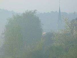
Craonne is a commune in the Aisne department in Hauts-de-France in northern France.
History
It was the site of the Napoleonic Battle of Craonne in 1814. The former town was totally destroyed by artillery in World War I and is now an arboretum; today's town was rebuilt in the 1920s.
Geography
The river Ailette forms part of the commune's northern border.
Population
| Historical population | ||
|---|---|---|
| Year | Pop. | ±% |
| 1962 | 150 | — |
| 1968 | 140 | −6.7% |
| 1975 | 96 | −31.4% |
| 1982 | 78 | −18.8% |
| 1990 | 68 | −12.8% |
| 1999 | 67 | −1.5% |
| 2008 | 68 | +1.5% |
Sights
See also
References
| Wikimedia Commons has media related to Craonne. |
This article is issued from Wikipedia - version of the 11/8/2016. The text is available under the Creative Commons Attribution/Share Alike but additional terms may apply for the media files.