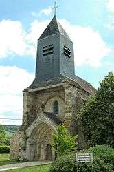
Saint-Eugène, Aisne
| Saint-Eugène | |
|---|---|
 | |
 Saint-Eugène | |
|
Location within Hauts-de-France region  Saint-Eugène | |
| Coordinates: 49°01′20″N 3°31′54″E / 49.0222°N 3.5317°ECoordinates: 49°01′20″N 3°31′54″E / 49.0222°N 3.5317°E | |
| Country | France |
| Region | Hauts-de-France |
| Department | Aisne |
| Arrondissement | Château-Thierry |
| Canton | Condé-en-Brie |
| Intercommunality | Condé en Brie |
| Government | |
| • Mayor (2008–2014) | Bertrand Pipeau |
| Area1 | 6.75 km2 (2.61 sq mi) |
| Population (2008)2 | 230 |
| • Density | 34/km2 (88/sq mi) |
| Time zone | CET (UTC+1) |
| • Summer (DST) | CEST (UTC+2) |
| INSEE/Postal code | 02677 / 02330 |
| Elevation |
70–231 m (230–758 ft) (avg. 75 m or 246 ft) |
|
1 French Land Register data, which excludes lakes, ponds, glaciers > 1 km² (0.386 sq mi or 247 acres) and river estuaries. 2 Population without double counting: residents of multiple communes (e.g., students and military personnel) only counted once. | |
Saint-Eugène is a commune in the Aisne départment in Hauts-de-France in northern France.
Population
| Historical population | ||
|---|---|---|
| Year | Pop. | ±% |
| 1962 | 191 | — |
| 1968 | 176 | −7.9% |
| 1975 | 148 | −15.9% |
| 1982 | 191 | +29.1% |
| 1990 | 191 | +0.0% |
| 1999 | 203 | +6.3% |
| 2008 | 230 | +13.3% |
See also
References
| Wikimedia Commons has media related to Saint-Eugène, Aisne. |
This article is issued from Wikipedia - version of the 11/8/2016. The text is available under the Creative Commons Attribution/Share Alike but additional terms may apply for the media files.