La Ville-aux-Bois-lès-Pontavert
| La Ville-aux-Bois-lès-Pontavert | |
|---|---|
 La Ville-aux-Bois-lès-Pontavert | |
|
Location within Hauts-de-France region  La Ville-aux-Bois-lès-Pontavert | |
| Coordinates: 49°25′43″N 3°51′02″E / 49.4286°N 3.8506°ECoordinates: 49°25′43″N 3°51′02″E / 49.4286°N 3.8506°E | |
| Country | France |
| Region | Hauts-de-France |
| Department | Aisne |
| Arrondissement | Laon |
| Canton | Neufchâtel-sur-Aisne |
| Intercommunality | Champagne Picarde |
| Government | |
| • Mayor (2008–2014) | François Saillard |
| Area1 | 8.32 km2 (3.21 sq mi) |
| Population (2008)2 | 117 |
| • Density | 14/km2 (36/sq mi) |
| Time zone | CET (UTC+1) |
| • Summer (DST) | CEST (UTC+2) |
| INSEE/Postal code | 02803 / 02160 |
| Elevation |
52–98 m (171–322 ft) (avg. 79 m or 259 ft) |
|
1 French Land Register data, which excludes lakes, ponds, glaciers > 1 km² (0.386 sq mi or 247 acres) and river estuaries. 2 Population without double counting: residents of multiple communes (e.g., students and military personnel) only counted once. | |
La Ville-aux-Bois-lès-Pontavert is a commune in the Aisne department in Hauts-de-France in northern France.
Population
| Historical population | ||
|---|---|---|
| Year | Pop. | ±% |
| 1962 | 96 | — |
| 1968 | 129 | +34.4% |
| 1975 | 96 | −25.6% |
| 1982 | 119 | +24.0% |
| 1990 | 109 | −8.4% |
| 1999 | 136 | +24.8% |
| 2008 | 117 | −14.0% |
See also
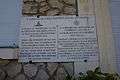 Memorial, 5ht field battery.
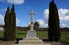 memorial, Devonshire Regiment.
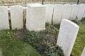 British cemetery.
References
| Wikimedia Commons has media related to La Ville-aux-Bois-lès-Pontavert. |
This article is issued from Wikipedia - version of the 11/8/2016. The text is available under the Creative Commons Attribution/Share Alike but additional terms may apply for the media files.