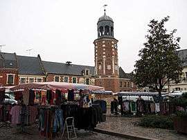
Crécy-sur-Serre
| Crécy-sur-Serre | ||
|---|---|---|
 | ||
| ||
 Crécy-sur-Serre | ||
|
Location within Hauts-de-France region  Crécy-sur-Serre | ||
| Coordinates: 49°41′52″N 3°37′24″E / 49.6978°N 3.6233°ECoordinates: 49°41′52″N 3°37′24″E / 49.6978°N 3.6233°E | ||
| Country | France | |
| Region | Hauts-de-France | |
| Department | Aisne | |
| Arrondissement | Laon | |
| Canton | Crécy-sur-Serre | |
| Intercommunality | Pays de la Serre | |
| Government | ||
| • Mayor (2001–2008) | Bernard Ronsin | |
| Area1 | 17.9 km2 (6.9 sq mi) | |
| Population (2008)2 | 1,471 | |
| • Density | 82/km2 (210/sq mi) | |
| Time zone | CET (UTC+1) | |
| • Summer (DST) | CEST (UTC+2) | |
| INSEE/Postal code | 02237 / 02270 | |
| Elevation |
57–133 m (187–436 ft) (avg. 62 m or 203 ft) | |
|
1 French Land Register data, which excludes lakes, ponds, glaciers > 1 km² (0.386 sq mi or 247 acres) and river estuaries. 2 Population without double counting: residents of multiple communes (e.g., students and military personnel) only counted once. | ||

Crécy-sur-Serre is a commune in the Aisne department in Hauts-de-France in northern France.
Population
| Historical population | ||
|---|---|---|
| Year | Pop. | ±% |
| 1793 | 1,780 | — |
| 1800 | 1,922 | +8.0% |
| 1806 | 2,009 | +4.5% |
| 1821 | 2,047 | +1.9% |
| 1831 | 2,085 | +1.9% |
| 1836 | 2,052 | −1.6% |
| 1841 | 2,034 | −0.9% |
| 1846 | 2,155 | +5.9% |
| 1851 | 2,216 | +2.8% |
| 1856 | 2,056 | −7.2% |
| 1861 | 2,085 | +1.4% |
| 1866 | 1,953 | −6.3% |
| 1872 | 1,965 | +0.6% |
| 1876 | 1,955 | −0.5% |
| 1881 | 1,943 | −0.6% |
| 1886 | 1,959 | +0.8% |
| 1891 | 1,926 | −1.7% |
| 1896 | 1,860 | −3.4% |
| 1901 | 1,845 | −0.8% |
| 1906 | 1,834 | −0.6% |
| 1911 | 1,666 | −9.2% |
| 1921 | 1,566 | −6.0% |
| 1926 | 1,637 | +4.5% |
| 1931 | 1,519 | −7.2% |
| 1936 | 1,602 | +5.5% |
| 1946 | 1,576 | −1.6% |
| 1954 | 1,671 | +6.0% |
| 1962 | 1,691 | +1.2% |
| 1968 | 1,598 | −5.5% |
| 1975 | 1,594 | −0.3% |
| 1982 | 1,700 | +6.6% |
| 1990 | 1,542 | −9.3% |
| 1999 | 1,550 | +0.5% |
| 2008 | 1,471 | −5.1% |
See also
References
| Wikimedia Commons has media related to Crécy-sur-Serre. |
This article is issued from Wikipedia - version of the 11/8/2016. The text is available under the Creative Commons Attribution/Share Alike but additional terms may apply for the media files.