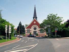
Gauchy
| Gauchy | |
|---|---|
 | |
 Gauchy | |
|
Location within Hauts-de-France region  Gauchy | |
| Coordinates: 49°49′30″N 3°16′14″E / 49.825°N 3.2706°ECoordinates: 49°49′30″N 3°16′14″E / 49.825°N 3.2706°E | |
| Country | France |
| Region | Hauts-de-France |
| Department | Aisne |
| Arrondissement | Saint-Quentin |
| Canton | Saint-Quentin-Sud |
| Intercommunality | Saint-Quentin |
| Government | |
| • Mayor (2008–2014) | Josette Henry |
| Area1 | 6.24 km2 (2.41 sq mi) |
| Population (2012)2 | 5,356 |
| • Density | 860/km2 (2,200/sq mi) |
| Time zone | CET (UTC+1) |
| • Summer (DST) | CEST (UTC+2) |
| INSEE/Postal code | 02340 / 02430 |
| Elevation |
68–118 m (223–387 ft) (avg. 80 m or 260 ft) |
|
1 French Land Register data, which excludes lakes, ponds, glaciers > 1 km² (0.386 sq mi or 247 acres) and river estuaries. 2 Population without double counting: residents of multiple communes (e.g., students and military personnel) only counted once. | |
Gauchy is a commune in the Aisne department in Hauts-de-France in northern France.
Population
| Historical population | ||
|---|---|---|
| Year | Pop. | ±% |
| 1793 | 169 | — |
| 1800 | 298 | +76.3% |
| 1806 | 266 | −10.7% |
| 1821 | 322 | +21.1% |
| 1831 | 348 | +8.1% |
| 1836 | 340 | −2.3% |
| 1841 | 317 | −6.8% |
| 1846 | 351 | +10.7% |
| 1851 | 366 | +4.3% |
| 1856 | 392 | +7.1% |
| 1861 | 375 | −4.3% |
| 1866 | 413 | +10.1% |
| 1872 | 465 | +12.6% |
| 1876 | 517 | +11.2% |
| 1881 | 584 | +13.0% |
| 1886 | 662 | +13.4% |
| 1891 | 635 | −4.1% |
| 1896 | 617 | −2.8% |
| 1901 | 569 | −7.8% |
| 1906 | 504 | −11.4% |
| 1911 | 507 | +0.6% |
| 1921 | 574 | +13.2% |
| 1926 | 2,529 | +340.6% |
| 1931 | 3,078 | +21.7% |
| 1936 | 2,451 | −20.4% |
| 1946 | 2,672 | +9.0% |
| 1954 | 3,112 | +16.5% |
| 1962 | 3,503 | +12.6% |
| 1968 | 4,218 | +20.4% |
| 1975 | 5,663 | +34.3% |
| 1982 | 5,612 | −0.9% |
| 1990 | 5,736 | +2.2% |
| 1999 | 5,604 | −2.3% |
| 2008 | 5,593 | −0.2% |
| 2012 | 5,356 | −4.2% |
See also
References
| Wikimedia Commons has media related to Gauchy. |
This article is issued from Wikipedia - version of the 11/8/2016. The text is available under the Creative Commons Attribution/Share Alike but additional terms may apply for the media files.