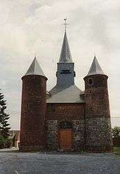
La Bouteille
| La Bouteille | ||
|---|---|---|
 | ||
| ||
 La Bouteille | ||
|
Location within Hauts-de-France region  La Bouteille | ||
| Coordinates: 49°51′37″N 3°58′22″E / 49.8603°N 3.9728°ECoordinates: 49°51′37″N 3°58′22″E / 49.8603°N 3.9728°E | ||
| Country | France | |
| Region | Hauts-de-France | |
| Department | Aisne | |
| Arrondissement | Vervins | |
| Canton | Vervins | |
| Intercommunality | Thiérache du Centre | |
| Government | ||
| • Mayor (2008–2014) | Cyrille Stevenot | |
| Area1 | 19 km2 (7 sq mi) | |
| Population (2008)2 | 509 | |
| • Density | 27/km2 (69/sq mi) | |
| Time zone | CET (UTC+1) | |
| • Summer (DST) | CEST (UTC+2) | |
| INSEE/Postal code | 02109 / 02140 | |
| Elevation |
125–223 m (410–732 ft) (avg. 214 m or 702 ft) | |
|
1 French Land Register data, which excludes lakes, ponds, glaciers > 1 km² (0.386 sq mi or 247 acres) and river estuaries. 2 Population without double counting: residents of multiple communes (e.g., students and military personnel) only counted once. | ||

La Bouteille is a commune in the department of Aisne in Hauts-de-France in northern France.
Population
| Historical population | ||
|---|---|---|
| Year | Pop. | ±% |
| 1793 | 824 | — |
| 1800 | 850 | +3.2% |
| 1806 | 971 | +14.2% |
| 1821 | 967 | −0.4% |
| 1831 | 1,044 | +8.0% |
| 1836 | 1,102 | +5.6% |
| 1841 | 1,068 | −3.1% |
| 1846 | 1,087 | +1.8% |
| 1851 | 1,104 | +1.6% |
| 1856 | 1,151 | +4.3% |
| 1861 | 1,134 | −1.5% |
| 1866 | 1,111 | −2.0% |
| 1872 | 1,072 | −3.5% |
| 1876 | 1,064 | −0.7% |
| 1881 | 969 | −8.9% |
| 1886 | 892 | −7.9% |
| 1891 | 907 | +1.7% |
| 1896 | 918 | +1.2% |
| 1901 | 940 | +2.4% |
| 1906 | 862 | −8.3% |
| 1911 | 827 | −4.1% |
| 1921 | 750 | −9.3% |
| 1926 | 737 | −1.7% |
| 1931 | 647 | −12.2% |
| 1936 | 692 | +7.0% |
| 1946 | 692 | +0.0% |
| 1954 | 669 | −3.3% |
| 1962 | 656 | −1.9% |
| 1968 | 633 | −3.5% |
| 1975 | 549 | −13.3% |
| 1982 | 514 | −6.4% |
| 1990 | 502 | −2.3% |
| 1999 | 508 | +1.2% |
| 2008 | 509 | +0.2% |
See also
References
| Wikimedia Commons has media related to La Bouteille. |
This article is issued from Wikipedia - version of the 11/8/2016. The text is available under the Creative Commons Attribution/Share Alike but additional terms may apply for the media files.