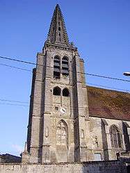
Taillefontaine
| Taillefontaine | |
|---|---|
 | |
 Taillefontaine | |
|
Location within Hauts-de-France region  Taillefontaine | |
| Coordinates: 49°18′43″N 3°02′36″E / 49.3119°N 3.0433°ECoordinates: 49°18′43″N 3°02′36″E / 49.3119°N 3.0433°E | |
| Country | France |
| Region | Hauts-de-France |
| Department | Aisne |
| Arrondissement | Soissons |
| Canton | Villers-Cotterêts |
| Intercommunality | Villers-Cotterêts–Forêt de Retz |
| Government | |
| • Mayor (2008–2014) | Jean-Michel Beviere |
| Area1 | 10.63 km2 (4.10 sq mi) |
| Population (2008)2 | 274 |
| • Density | 26/km2 (67/sq mi) |
| Time zone | CET (UTC+1) |
| • Summer (DST) | CEST (UTC+2) |
| INSEE/Postal code | 02734 / 02600 |
| Elevation |
65–238 m (213–781 ft) (avg. 103 m or 338 ft) |
|
1 French Land Register data, which excludes lakes, ponds, glaciers > 1 km² (0.386 sq mi or 247 acres) and river estuaries. 2 Population without double counting: residents of multiple communes (e.g., students and military personnel) only counted once. | |
Taillefontaine is a commune in the Aisne department in Hauts-de-France in northern France.
Population
| Historical population | ||
|---|---|---|
| Year | Pop. | ±% |
| 1962 | 346 | — |
| 1968 | 320 | −7.5% |
| 1975 | 281 | −12.2% |
| 1982 | 255 | −9.3% |
| 1990 | 270 | +5.9% |
| 1999 | 287 | +6.3% |
| 2008 | 274 | −4.5% |
See also
References
| Wikimedia Commons has media related to Taillefontaine. |
This article is issued from Wikipedia - version of the 11/8/2016. The text is available under the Creative Commons Attribution/Share Alike but additional terms may apply for the media files.