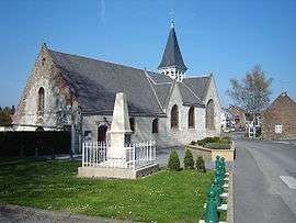
Homblières
| Homblières | |
|---|---|
 | |
 Homblières | |
|
Location within Hauts-de-France region  Homblières | |
| Coordinates: 49°51′02″N 3°21′55″E / 49.8506°N 3.3653°ECoordinates: 49°51′02″N 3°21′55″E / 49.8506°N 3.3653°E | |
| Country | France |
| Region | Hauts-de-France |
| Department | Aisne |
| Arrondissement | Saint-Quentin |
| Canton | Saint-Quentin-Sud |
| Intercommunality | Saint-Quentin |
| Government | |
| • Mayor (2008–2014) | Bernadette Bleuse |
| Area1 | 14.29 km2 (5.52 sq mi) |
| Population (2008)2 | 1,417 |
| • Density | 99/km2 (260/sq mi) |
| Time zone | CET (UTC+1) |
| • Summer (DST) | CEST (UTC+2) |
| INSEE/Postal code | 02383 / 02720 |
| Elevation |
72–135 m (236–443 ft) (avg. 84 m or 276 ft) |
|
1 French Land Register data, which excludes lakes, ponds, glaciers > 1 km² (0.386 sq mi or 247 acres) and river estuaries. 2 Population without double counting: residents of multiple communes (e.g., students and military personnel) only counted once. | |
Homblières is a commune in the Aisne department in Hauts-de-France in northern France.
Population
| Historical population | ||
|---|---|---|
| Year | Pop. | ±% |
| 1962 | 820 | — |
| 1968 | 891 | +8.7% |
| 1975 | 915 | +2.7% |
| 1982 | 1,223 | +33.7% |
| 1990 | 1,495 | +22.2% |
| 1999 | 1,462 | −2.2% |
| 2008 | 1,417 | −3.1% |
See also
References
| Wikimedia Commons has media related to Homblières. |
This article is issued from Wikipedia - version of the 11/8/2016. The text is available under the Creative Commons Attribution/Share Alike but additional terms may apply for the media files.