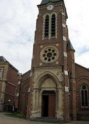
Le Nouvion-en-Thiérache
| Le Nouvion-en-Thiérache | ||
|---|---|---|
 | ||
| ||
 Le Nouvion-en-Thiérache | ||
|
Location within Hauts-de-France region  Le Nouvion-en-Thiérache | ||
| Coordinates: 50°01′05″N 3°47′09″E / 50.0181°N 3.7858°ECoordinates: 50°01′05″N 3°47′09″E / 50.0181°N 3.7858°E | ||
| Country | France | |
| Region | Hauts-de-France | |
| Department | Aisne | |
| Arrondissement | Vervins | |
| Canton | Le Nouvion-en-Thiérache | |
| Intercommunality | Thiérache du Centre | |
| Government | ||
| • Mayor (2008–2014) | Guy Verin | |
| Area1 | 48.42 km2 (18.70 sq mi) | |
| Population (2012)2 | 2,801 | |
| • Density | 58/km2 (150/sq mi) | |
| Time zone | CET (UTC+1) | |
| • Summer (DST) | CEST (UTC+2) | |
| INSEE/Postal code | 02558 / 02170 | |
| Elevation |
154–229 m (505–751 ft) (avg. 185 m or 607 ft) | |
|
1 French Land Register data, which excludes lakes, ponds, glaciers > 1 km² (0.386 sq mi or 247 acres) and river estuaries. 2 Population without double counting: residents of multiple communes (e.g., students and military personnel) only counted once. | ||

Le Nouvion-en-Thiérache is a commune in the Aisne department in Hauts-de-France in northern France.
Population
| Historical population | ||
|---|---|---|
| Year | Pop. | ±% |
| 1793 | 3,018 | — |
| 1800 | 3,357 | +11.2% |
| 1806 | 3,082 | −8.2% |
| 1821 | 3,158 | +2.5% |
| 1831 | 3,106 | −1.6% |
| 1836 | 3,068 | −1.2% |
| 1841 | 3,045 | −0.7% |
| 1846 | 3,240 | +6.4% |
| 1851 | 3,295 | +1.7% |
| 1856 | 3,094 | −6.1% |
| 1861 | 3,070 | −0.8% |
| 1866 | 3,261 | +6.2% |
| 1872 | 3,172 | −2.7% |
| 1876 | 3,273 | +3.2% |
| 1881 | 3,334 | +1.9% |
| 1886 | 3,209 | −3.7% |
| 1891 | 3,110 | −3.1% |
| 1896 | 3,085 | −0.8% |
| 1901 | 3,189 | +3.4% |
| 1906 | 2,977 | −6.6% |
| 1911 | 2,875 | −3.4% |
| 1921 | 2,628 | −8.6% |
| 1926 | 2,851 | +8.5% |
| 1931 | 2,623 | −8.0% |
| 1936 | 2,636 | +0.5% |
| 1946 | 2,455 | −6.9% |
| 1954 | 2,684 | +9.3% |
| 1962 | 3,096 | +15.4% |
| 1968 | 3,343 | +8.0% |
| 1975 | 3,247 | −2.9% |
| 1982 | 3,139 | −3.3% |
| 1990 | 2,905 | −7.5% |
| 1999 | 2,917 | +0.4% |
| 2008 | 2,829 | −3.0% |
| 2012 | 2,801 | −1.0% |
See also
References
| Wikimedia Commons has media related to Le Nouvion-en-Thiérache. |
This article is issued from Wikipedia - version of the 11/8/2016. The text is available under the Creative Commons Attribution/Share Alike but additional terms may apply for the media files.